


Click Image to Enlarge
Kansas Counties
Kansas has one hundred and five counties. Originally 33 counties were organized by the Territorial Legislature in 1855. The Chase County Courthouse in Cottonwood Falls, Kansas was built in 1873 and is the oldest operating courthouse in Kansas. As of January 1, 2009 Greeley County and the city of Tribune unified to form the Unified Government of Greeley County..Clay County, Kansas
Clay County Education, Geography, and History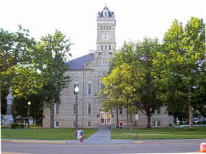
Clay County is a county located in the state of Kansas. Based on the 2010 census, the county population was 8,535. Clay County was created on February 20, 1857. The county seat and most populous city is Clay Center. Clay county is named in honor of Henry Clay (1777-1852), influential United States Senator from Kentucky.
Etymology - Origin of Clay County Name
Clay county is named in honor of the distinguished Kentucky statesman, Henry Clay, who was chosen United States Senator in 1806. Henry Clay, later served in both houses and was in public life most of the time during a period of forty-six years. He was minister to England and France, and candidate for President in opposition to Polk. He died in Washington in 1852.
Demographics:
County QuickFacts: CensusBureau Quick Facts
Clay County History
Clay County, in the northeastern part of the state, is in the second tier of counties south of Nebraska, and its eastern boundary is about 100 miles west of the Missouri river. It is bounded on the north by Washington county; east by Geary and Riley; south by Dickinson, and west by Ottawa and Cloud, and has an area of 660 square miles. By an act of the first territorial legislature in 1855, the territory embraced within the present limits of Clay county was attached to Riley county for all revenue and judicial purposes. Subsequently Clay was attached to Geary county. In 1857 Clay was created and named in honor of the great compromise statesman, Henry Clay.
Agriculture is the principal occupation. Corn, winter wheat and oats are the chief crops, while in 1907 there were 150,000 bearing fruit trees, peach and apple being the leading varieties. The county stands well to the front in stock raising and dairy products.
Geography: Land and Water
As reported by the Census Bureau, the county has a total area of 656 square miles (1,700 km2), of which 645 square miles (1,670 km2) is land and 10 square miles (26 km2) (1.6%) is water.
Clay county is located in northeast Kansas. The county is rolling prairie apart from the north area of Oakland and the southern part of Five Creeks townships, which are high and rocky. Timber in this county consist of cottonwood, red and white elm, oak, hackberry and locust. Sandstone and magnesium limestone are plentiful. Clay for brick and pottery is ample and red ochre and gypsum are also found.
Neighboring Counties
Bordering counties are as follows:
- North: Washington County
- East: Riley County
- Southeast: Geary County
- South: Dickinson County
- Southwest: Ottawa County
- Northwest: Cloud County
Education
Unified School Districts
Clay County USD 379, located in Clay Center


Click Image to Enlarge
