


Click Image to Enlarge
Kansas Counties
Kansas has one hundred and five counties. Originally 33 counties were organized by the Territorial Legislature in 1855. The Chase County Courthouse in Cottonwood Falls, Kansas was built in 1873 and is the oldest operating courthouse in Kansas. As of January 1, 2009 Greeley County and the city of Tribune unified to form the Unified Government of Greeley County..Coffey County, Kansas
Coffey County Education, Geography, and History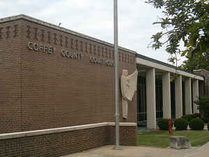
Coffey County is a county located in Eastern Kansas. Based on the 2010 census, the county population was 8,601. Coffey County was created on August 25, 1855. The county seat and most populous city is Burlington. The county is named in honor of Colonel A.M. Coffey, a member of the first Territorial Legislative Council.
Etymology - Origin of Coffey County Name
The county is named in honor of Colonel A. M. Coffey, a member of the first Territorial Legislative Council. Colonel Coffey died at Dodge City in 1879.
Demographics:
County QuickFacts: CensusBureau Quick Facts
Coffey County History
Coffey County, in the third tier of counties from the Missouri line, and the fourth tier from Oklahoma, is bounded on the north by Osage county; on the east by Franklin and Anderson; on the south by Woodson, and on the west by Greenwood and Lyon. Its area is 648 square miles, and it was named for Col. A. M. Coffey, a member of the first territorial legislature.
The boundaries of the county were fixed by act of the legislature in July, 1855, as follows: "Beginning at the southeast corner of Weller (Osage) county, thence south 24 miles; thence west 24 miles; thence north 24 miles, and thence east 24 miles to the place of beginning." Although the county was not yet organized a court was established at Hampden under Judge Cato, which the next year was moved to Le Roy. When the legislature officially organized the county in 1857 Le Roy was made the temporary county seat
Geography: Land and Water
As reported by the Census Bureau, the county has a total area of 654 square miles (1,690 km2), of which 627 square miles (1,620 km2) is land and 27 square miles (70 km2) (4.2%) is water.
Coffey
county is located in east Kansas. This county is an agricultural county. The
county is rolling prairie. The native trees are oak, hickory, hackberry, elm, black walnut, sycamore, soft maple, box elder, ash, locust and pecan.
Sandstone, red ocher and clay for brick and tile are found in commercial quantities.
There are many salt springs and marshes along the Neosho river. The county is under laid with natural gas.
The Neosho river, the principal stream crosses in a southeasterly
direction.
Neighboring Counties
Bordering counties are as follows:
- North: Osage County
- Northeast: Franklin County
- East: Anderson County
- Southeast: Allen County
- South: Woodson County
- Southwest: Greenwood County
- Northwest: Lyon County
Education
Unified School Districts
Lebo-Waverly USD 243
Burlington USD 244
Leroy-Gridley USD 245


Click Image to Enlarge
