


Click Image to Enlarge
Kansas Counties
Kansas has one hundred and five counties. Originally 33 counties were organized by the Territorial Legislature in 1855. The Chase County Courthouse in Cottonwood Falls, Kansas was built in 1873 and is the oldest operating courthouse in Kansas. As of January 1, 2009 Greeley County and the city of Tribune unified to form the Unified Government of Greeley County..Dickinson County, Kansas
Dickinson County Education, Geography, and History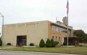
Dickinson County is a county located in Central Kansas. Based on the 2010 census, the county population was 19,754. Dickinson County was created on February 20, 1857. The county seat and most populous city is Abilene. The county is named in honor of Daniel S. Dickinson, United States Senator from New York and a Kansas statehood advocate.
Etymology - Origin of Dickinson County Name
The county is named in honor of Daniel S. Dickinson, who was a Senator from the State of New York. In 1847 he introduced, in the United States Senate, resolutions respecting territorial government, embodying the doctrine of popular sovereignty, afterwards incorporated in the Bill for the organization of Kansas Territory. He died in 1866.
Demographics:
County QuickFacts: CensusBureau Quick Facts
Dickinson County History
For many millennia, the Great Plains of North America was inhabited by nomadic Native Americans. From the 16th century to 18th century, the
Kingdom of France claimed ownership of large parts of North America. In 1762, after the French and Indian War, France secretly ceded New
France to Spain, per the Treaty of Fontainebleau. In 1802, Spain returned most of the land to France, but keeping title to about 7,500 square
miles.
In 1803, most of the land for modern day Kansas was acquired by the United States from France as part of the 828,000 square mile Louisiana
Purchase for 2.83 cents per acre. In 1848, after the Mexican-American War, the Treaty of Guadalupe Hidalgo with Spain brought into the United
States all or part of land for ten future states, including southwest Kansas. In 1854, the Kansas Territory was organized, then in 1861 Kansas
became the 34th US state.
Dickinson County, located near the central part of the state, is in the third tier of counties south from Nebraska and the sixth west from the Missouri river. It was created by an act of the legislature in 1857, with the following boundaries: "Beginning at the southwest corner of Clay county, thence west along the southern boundary of said Clay county to the southwest corner thereof; thence south along the 6th principal meridian to the corner of townships 16 and 17 south; thence east along the township line to the range line between ranges 4 and 5 east; thence north along said range line to the middle of the main channel of the Smoky Hill fork of the Kansas river; thence up the middle of the main channel of the Smoky Hill fork to the southwest corner of Riley county; thence north with the west boundary of Riley county to the point of beginning." It was named after Daniel S. Dickinson, United States senator from the state of New York. The boundaries at present are practically those established by the act of creation and it is bounded on the north by Clay county, on the east by Geary and Morris, on the south by Marion and on the west by Saline and Ottawa counties. Its area is 851 square miles.
The county is well adapted to agriculture, the principal crops being winter wheat, corn, and other grains. Tame grasses and prairie hay are also important products and Dickinson ranks high as one of the great stock raising counties. There are more than 225,000 bearing fruit trees, about half of which are apple.
Geography: Land and Water
As reported by the Census Bureau, the county has a total area of 852 square miles (2,210 km2), of which 847 square miles (2,190 km2) is land and 4.9 square miles (13 km2) (0.6%) is water.
Dickinson county is located close to the center of Kansas.The country is gently rolling prairie which breaks into bluffs along some of the streams. The bottom land comprises about a quarter of the total area and the soil is rich and deep growing somewhat thinner on the upland. Timber is mostly walnut, ash, elm, hackberry, burr oak, cottonwood, hickory, honey-locust, box-elder and sycamore. The largest water course is the Smoky Hill river, which flows across the county from west to east, a little north of the center. An excellent quality of limestone is abundant; mineral paint and clay for brick and pottery is found near Abilene; gypsum is plentiful in the southwest and is extensively utilized. Salt water is found at Solomon, in the western part of the county and in Hope township in the southwest. There are two mineral springs at Abilene supposed to have medical properties and the water is bottled and shipped to some extent.
Neighboring Counties
Bordering counties are as follows:
- North: Clay County
- Northeast: Geary County
- Southeast: Morris County
- South: Marion County
- Southwest: McPherson County
- West: Saline County
- Northwest: Ottawa County
Education
Unified School Districts
USD 393, Solomon -Solomon, Rural Areas
USD 435, Abilene - Abilene, Rural Areas
USD 473, Chapman - Chapman, Carlton, Manchester, Enterprise, Rural Areas
USD 487, Herington - Herington, Rural Areas
District Office In Neighboring County
USD 481, Rural Vista - Hope, Woodbine, Rural Areas


Click Image to Enlarge
