


Click Image to Enlarge
Kansas Counties
Kansas has one hundred and five counties. Originally 33 counties were organized by the Territorial Legislature in 1855. The Chase County Courthouse in Cottonwood Falls, Kansas was built in 1873 and is the oldest operating courthouse in Kansas. As of January 1, 2009 Greeley County and the city of Tribune unified to form the Unified Government of Greeley County..Ford County, Kansas
Ford County Education, Geography, and History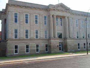
Ford County is a county located in the state of Kansas. Based on the 2010 census, the county
population was 33,848. Ford County was created
on February 26, 1867. The county seat and most populous
city is Dodge City. The county is named in honor of
Colonel James Hobart Ford, Union general in the Civil War who mainly
fought in Kansas and Missouri.
The Dodge City, KS Micropolitan Statistical Area includes all of Ford County.
Etymology - Origin of Ford County Name
The county is named in honor of Colonel James H. Ford, of the Second Colorado Cavalry, and Brevet Brigadier-General of the United States Volunteers.
Demographics:
County QuickFacts: CensusBureau Quick Facts
Ford County History
Ford County, located in the southwestern part of the state, is in the second tier of counties north of the line dividing Kansas from Oklahoma, and the fifth county east from the Colorado state line. It is bounded on the north by Hodgeman county, east by Edwards and Kiowa, south by Clark and Meade and west by Gray, and has an area of 1,080 square miles. Ford county was created by the act of 1867, which provided for the division into counties of all the unorganized part of the state east of range 26 west, and was named in honor of Col. James H. Ford of the Second Colorado cavalry. It was not organized until 1873.
Winter wheat, barley, oats and corn are the leading grains, Kafir corn, alfalfa and sorghum are extensively raised, and the county ranks high in live stock.
Geography: Land and Water
As reported by the Census Bureau, the county has a total area of 1,099 square miles (2,850 km2), of which 1,098 square miles (2,840 km2) is land and 0.8 square miles (2.1 km2) (0.07%) is water.
Ford county is located in southwest Kansas. The county is mostly level. Nearly all the bottom land in the county is the valley of the Arkansas river and contains about one-tenth of the area of the county. There is little native timber, and what there is consists of mostly cottonwood, and some hackberry, walnut and cedar. The Arkansas river enters the county about 8 miles south of the northwest corner, flows southeast nearly to the eastern boundary. Saw Log creek, a branch of the Pawnee, flows through the northern section. Magnesian limestone of good quality exists near Dodge City, and sandstone is found in the bluffs along the Arkansas river. Gypsum is common in the northern portion, along Saw Log creek.
Neighboring Counties
Bordering counties are as follows:
- Hodgeman County (north)
- Edwards County (northeast)
- Kiowa County (east)
- Clark County (south)
- Meade County (southwest)
- Gray County (west)
Cities and Towns:
Education
Unified School Districts
Spearville USD 381
Dodge City USD 443
Bucklin USD 459
Colleges
Dodge City Community College


Click Image to Enlarge
