


Click Image to Enlarge
Kansas Counties
Kansas has one hundred and five counties. Originally 33 counties were organized by the Territorial Legislature in 1855. The Chase County Courthouse in Cottonwood Falls, Kansas was built in 1873 and is the oldest operating courthouse in Kansas. As of January 1, 2009 Greeley County and the city of Tribune unified to form the Unified Government of Greeley County..Harper County, Kansas
Harper County Education, Geography, and History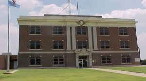
Harper County is a county located in the state of Kansas. Based on the 2010 census, the county population was 6,034. Harper County was created on February 26, 1867. The county seat and most populous city is Anthony. The county is named for Sergeant Marion Harper of the 2nd Kansas Cavalry, who died of wounds suffered near Waldron, Arkansas, in December 1863.
Etymology - Origin of Harper County Name
The county was named in memory of Marion Harper, first sergeant of Company E, Second Regiment Kansas Cavalry. He was mortally wounded at Waldron, Ark., December 29, 1863, and died the following day. When brought in wounded, he proposed a wager that in so many hours he would be dead; the bet was taken, and Marion Harper won.
Demographics:
County QuickFacts: CensusBureau Quick Facts
Harper County History
Harper County, located in the central part of the southern tier of counties, is bounded on the north by Kingman county, on the east by Sumner, on the south by the State of Oklahoma and on the west by Barber county. It was first organized in 1873 and named in honor of Marion Harper, of the Second
Kansas cavalry. As first described the boundaries of Harper included the southern tier of townships in what is now Kingman county. The bill fixing the final boundaries passed the legislature in 1879. The organization of 1873 proved to be one of the most gigantic frauds ever perpetrated in connection
with county organizations. There was not at that time a single resident in the county, and it was heavily bonded immediately. In 1873 three men from Cherokee county named Boyd, Wiggins and Homer, having laid a scheme to organize some of the uninhabited lands of southwestern Kansas for the purpose of
exploitation, came into the territory which is now Harper county, where they met a trapper by the name of George Lutz, who took them to his camp. Taking Lutz into their scheme, a petition was drawn up asking that John Davis be appointed special census taker, and that H. H. Weaver, H. P. Fields and
Samuel Smith be appointed special county commissioners. These names were copied from a Cincinnati directory. The petition further asked that Bluff City, "centrally located in the county, and being the largest and most important business point in the county," be made the temporary county seat. To
this petition was attached 40 names. The governor granted the petition and a census report was sent in which showed 641 names, of persons declared to be "bona fide" residents. The county was then declared organized.
The organization of this county was one of the most glaring frauds ever perpetrated in the State. Attorney-General Williams, in his official report, says: "It is not pretended that Harper county ever had an inhabitant." The form of its organization was legal on paper, and that is all. In 1878 the organization became legal.
Geography: Land and Water
As reported by the Census Bureau, the county has a total area of 803 square miles (2,080 km2), of which 801 square miles (2,070 km2) is land and 1.5 square miles (3.9 km2) (0.2%) is water.
Harper county is located in south Kansas. The county is rolling prairie, with long gentle slopes. Timber is very sparse and most of it is cottonwood. Red sandstone, mineral paint and salt are found in large amounts and are of superior quality. The largest stream is the Chikaskia river, which flows across the northeast corner. Bluff creek and its many tributaries nearly form the water system of the county. This stream crosses the county in a southeast direction.
Neighboring Counties
Bordering counties are as follows:
- Kingman County (north)
- Sumner County (east)
- Grant County, Oklahoma (southeast)
- Alfalfa County, Oklahoma (southwest)
- Barber County (west)
Education
Unified School Districts
Anthony-Harper USD 361
Attica USD 511


Click Image to Enlarge
