


Click Image to Enlarge
Kansas Counties
Kansas has one hundred and five counties. Originally 33 counties were organized by the Territorial Legislature in 1855. The Chase County Courthouse in Cottonwood Falls, Kansas was built in 1873 and is the oldest operating courthouse in Kansas. As of January 1, 2009 Greeley County and the city of Tribune unified to form the Unified Government of Greeley County..Jackson County, Kansas
Jackson County Education, Geography, and History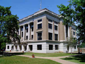
Jackson County is a county located in the state of Kansas. Based on the 2010 census, the county
population was 13,462. Calhoun County was
created on August 25, 1855 and renamed to Jackson
County on February 11, 1859. The county seat and most populous city is Holton. The county
is named for President Andrew Jackson.
Jackson County is included in the Topeka, KS Metropolitan Statistical Area.
The Prairie Band Potawatomi Indian Reservation, located near the center of the county, comprises about 18.5% of the county's area.
Etymology - Origin of Jackson County Name
Originally Calhoun, in honor of John C. Calhoun, of South Carolina, changed in 1859 to Jackson after Andrew Jackson, seventh President of the United States.
Demographics:
County QuickFacts: CensusBureau Quick Facts
Jackson County History
Jackson County, one of the counties formed by the first territorial legislature in 1855, is located in the second tier south from Nebraska, and the second west from Missouri. It is bounded on the west by Pottawatomie county, on the south by Wabaunsee and Shawnee, on the east by Jefferson and
Atchison, and on the north by Nemaha and Brown. It is 1,172 feet above the level of the sea.
The boundaries defined by the legislature of 1855 contained 1,140 square miles. The county was first called Calhoun (q. v.) in honor of John C. Calhoun. The county was surveyed in the same year and a place 7 miles from Topeka near the old Calhoun Bluffs was made the first county seat. New
boundary lines were defined in 1857, when the actual organization of the county took place, and the present boundary lines were established by the legislature in 1858, when the county seat was located permanently at Holton.
The name of the county was changed from Calhoun to Jackson by Golden Silvers, who was the representative in the legislature in 1858. The county officials did not recognize the new name until a year later. In 1858 a vote was taken to choose a new county seat and Holton received 79 votes over all
other contestants. The county voted 51 to 12 for a free-state constitution.
Geography: Land and Water
As reported by the Census Bureau, the county has a total area of 658 square miles (1,700 km2), of which 656 square miles (1,700 km2) is land and 1.8 square miles (4.7 km2) (0.3%) is water.
Jackson county is located in east Kansas. The county is rolling plains. The largest stream is the Big Soldier, which flows from north to south through the western part of the county and empties into the Kansas river. Other streams are Cross creek, Little Soldier, North and South Cedar creeks, Straight, Elk, Spring, Bills and Muddy creeks.
Neighboring Counties
Bordering counties are as follows:
- Brown County (northeast)
- Atchison County (east)
- Jefferson County (southeast)
- Shawnee County (south)
- Pottawatomie County (west)
- Nemaha County (northwest)
Education
Unified School Districts
Jackson Heights USD 335
Holton USD 336
Royal Valley USD 337


Click Image to Enlarge
