


Click Image to Enlarge
Kansas Counties
Kansas has one hundred and five counties. Originally 33 counties were organized by the Territorial Legislature in 1855. The Chase County Courthouse in Cottonwood Falls, Kansas was built in 1873 and is the oldest operating courthouse in Kansas. As of January 1, 2009 Greeley County and the city of Tribune unified to form the Unified Government of Greeley County..Johnson County, Kansas
Johnson County Education, Geography, and History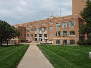
Johnson County is a county located in the state of Kansas. Based on the 2010 census, the county
population was 544,179,
making it the most populous county in Kansas. Johnson County was
created on August 25, 1855. The county seat is Olathe.
The county is named in honor of Reverend Thomas Johnson
(1802-1865), who established a mission to the Shawnee Indians in 1829,
Methodist missionary who was one of the state's first settlers.
Johnson County is included in the Kansas City, MO-KS Metropolitan Statistical Area. The county contains many of Kansas City's affluent
southwestern suburbs.
Etymology - Origin of Johnson County Name
The county is named for Reverend Thomas Johnson, who in 1829 established a mission among the Shawnee Indians about eight miles southwest of Kansas City. Reverend Johnson took the Pro-Slavery side of politics, and was the President of the first Territorial Council. He was shot and killed, in January 1865.
Demographics:
County QuickFacts: CensusBureau Quick Facts
Johnson County History
Johnson County, located in the eastern tier, is the sixth north from Oklahoma. It is bounded on the north by Leavenworth and Wyandotte counties; on the east by the State of Missouri; on the south by Miami county, and on the west by Douglas county. Its area is 480 square miles, or 307,200 acres, and in 1910 it ranked 33d, with a population of 18,288. It was organized in 1855 and named for Rev. Thomas Johnson, missionary to the Shawnee Indians, in what is now Shawnee township in the northern part of the county. In 1855 the Kansas river constituted its entire northern boundary but in 1859 the present boundary was established.
It's hard to believe that in 1900, Johnson County had fewer people than Jewell County. Today, the area's population is exploding, and new office parks and subdivisions seem to sprout overnight.
Johnson ranks among the foremost counties in the production of Irish potatoes. It also has a large number of orchards. In 1907 there were 150,000 bearing fruit trees.
Geography: Land and Water
As reported by the Census Bureau, the county has a total area of 480 square miles (1,200 km2), of which 473 square miles (1,230 km2) is land and 6.5 square miles (17 km2) (1.4%) is water.
Johnson county is located in east Kansas. The county is slightly rolling prairie. The valleys of rivers and creeks average from one-fourth to seven-eighths of a mile in width. The bottom lands comprise about 10 per cent. of the county. Timber in the county consist of oak, hickory, elm, walnut, mulberry, redbud, locust, wild cherry and sycamore, jack-oak and hickory existing in the largest quantities. There are many streams in Johnson county. The Kansas river flows north and forms more than half of the northern border. Blue and Indian creeks run east. The soil is from one to six feet in depth and is very productive, being adapted to corn, winter wheat, oats, flax and hay. Along the streams limestone is found in great quantity and is used extensively for building and as ballast for railroads. Sandstone is abundant in the north and east, and at Edgerton gray marble is found. Coal exists in a few places, where it is mined for local use.
Neighboring Counties
Bordering counties are as follows:
- Wyandotte County (north)
- Jackson County, Missouri (east)
- Cass County, Missouri (southeast)
- Miami County (south)
- Franklin County (southwest)
- Douglas County (west)
- Leavenworth County (northwest)
Education
According to the 2010 Census Bureau, the education attainment of the population 25 years and over: 95.6% high school graduate or higher, 51.1% bachelor's degree or higher, and 17.9% graduate or professional degree.
Unified School Districts
Blue Valley USD 229
Spring Hill USD 230
Gardner Edgerton USD 231
De Soto USD 232
Olathe USD 233
Shawnee Mission USD 512
Colleges and universities
Johnson County Community College
University of Kansas, Edwards Campus
Kansas State University, Olathe Campus
MidAmerica Nazarene University
Baker University, Overland Park Campus
Ottawa University, Overland Park Campus


Click Image to Enlarge
