


Click Image to Enlarge
Kansas Counties
Kansas has one hundred and five counties. Originally 33 counties were organized by the Territorial Legislature in 1855. The Chase County Courthouse in Cottonwood Falls, Kansas was built in 1873 and is the oldest operating courthouse in Kansas. As of January 1, 2009 Greeley County and the city of Tribune unified to form the Unified Government of Greeley County..Kearny County, Kansas
Kearny County Education, Geography, and History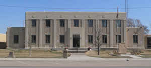
Kearny County is a county located in the state of Kansas. Based on the 2010 census, the county
population was 3,977. Kearny County was created
on March 20, 1873. The county seat and most populous city is Lakin. The county is
named in honor of General Philip Kearny.
Kearny County is included in the Garden City, KS Micropolitan Statistical Area.
Etymology - Origin of Kearny County Name
The county is named after General Kearny, who commanded United States troops in the West during the Indian troubles.
Demographics:
County QuickFacts: CensusBureau Quick Facts
Kearny County History
Kearny County, one of the newer counties of the state, is the second east from the Colorado line, and the third north from Oklahoma. It is bounded on the north by the county of Wichita; on the east by Finney; on the south by Grant, and on the west by Hamilton. It was named for Gen. Philip Kearny,
an officer of note in the Civil and Indian wars. It was first created and the boundaries defined in 1879. These boundaries did not differ from those defined in 1887, which are the same as at present. The description was as follows: "Commencing at the intersection of the east line of range 35 west
with the 4th standard parallel; thence south along range line to its intersection with the north line of township 27 south; thence west along township line to where it is intersected by the east line of range 39; thence north along range line to its intersection with the 4th standard parallel;
thence east to the place of beginning."
In 1879 it was attached to Hamilton county for judicial purposes. In 1881 it was one of the unorganized counties to be attached to Ford for judicial purposes and was in the 16th district.
Geography: Land and Water
As reported by the Census Bureau, the county has a total area of 871 square miles (2,260 km2), of which 871 square miles (2,260 km2) is land and 0.4 square miles (1.0 km2) (0.05%) is water.
Kearny county is located in west Kansas. The county is level or rolling, with an elevation of 3,000 feet. Water is easily accessible. The bottom lands in the valley of the Arkansas are from 4 to 6 miles in width. This Arkansas river enters in the southwest and flows across southeast, east and northeast. Limestone and sandstone for building are abundant. Blue limestone, from which lime is made, and gypsum are common.
Neighboring Counties
Bordering counties are as follows:
- Wichita County (north)
- Scott County (northeast)
- Finney County (east)
- Haskell County (southeast)
- Grant County (south)
- Stanton County (southwest)
- Hamilton County (west)
Education
Unified School Districts
Lakin USD 215
Deerfield USD 216


Click Image to Enlarge
