


Click Image to Enlarge
Kansas Counties
Kansas has one hundred and five counties. Originally 33 counties were organized by the Territorial Legislature in 1855. The Chase County Courthouse in Cottonwood Falls, Kansas was built in 1873 and is the oldest operating courthouse in Kansas. As of January 1, 2009 Greeley County and the city of Tribune unified to form the Unified Government of Greeley County..Kiowa County, Kansas
Kiowa County Education, Geography, and History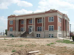
Kiowa County is a county located in the state of Kansas. Based on the 2010 census, the county population was 2,553. Kiowa County was created on February 26, 1867. The county seat is Greensburg. The county is named for the Kiowa Native Americans, who inhabited the area.
Etymology - Origin of Kiowa County Name
The county is named after the Kiowa Indians.
Demographics:
County QuickFacts: CensusBureau Quick Facts
Kiowa County History
Kiowa County, in the southwestern part of the state, is the second county north from Oklahoma and the sixth east from Colorado. It is bounded on the north by Edwards county; on the east by Pratt and Barber; on the south by Comanche, and on the west by Ford and Clark. It was named for the Kiowa
tribe of Indians and was first created by the act of 1867, which erected 26 western counties. In 1875 the county was extinguished and the territory divided between Edwards and Comanche. In 1886 Kiowa was restored and the boundaries defined as follows: "Commencing at the intersection of the west line
of range 20 west with the north line of town 27; thence south along range line to its intersection with the north line of township 31; thence east along township line to where it intersects with the west line of range 15 west; thence north along range line to where it intersects with the north line
of township 27; thence west to the place of beginning."
It contains 720 square miles or 460,800 acres. Until its organization Kiowa was attached to Comanche county for judicial purposes.
"Greensburg is the liveliest town in the state today, for money, marbles or watermelons"
- from the Kiowa County Signal June 1, 1888
Greensburg was named for stagecoach driver D. R. Green. He once ejected Carrie
Nation from his coach after she snatched a cigar from his mouth and tossed it
away.
On October 23, 1911, Greensburg's first speeding ticket involving an auto was
issued for exceeding the speed limit of 10mph.
Kiowa County has a large number of iron-rich meteorites in its soil due to the Brenham meteor fall over 10 thousand years ago.
Geography: Land and Water
As reported by the Census Bureau, the county has a total area of 723 square miles (1,870 km2), of which 723 square miles
(1,870 km2) is land and 0.2 square miles (0.52 km2) (0.03%) is water.
Kiowa county is located in southwest Kansas. The county is a rolling prairie, a little higher in the center. The southern half lies in the valley of the Medicine Lodge river. The northern half slopes in a series of gentle foot hills toward the valley of the Arkansas. Rattlesnake creek, the principal stream, enters in the west and flows northeast into Edwards county. Good building stone is plentiful.
Neighboring Counties
Bordering counties are as follows:
- Edwards County (north)
- Pratt County (east)
- Barber County (southeast)
- Comanche County (south)
- Clark County (southwest)
- Ford County (west)
Education
Unified School Districts
Greensburg USD 422
Mullinville USD 424
Haviland USD 474
Colleges
Barclay College, Haviland


Click Image to Enlarge
