


Click Image to Enlarge
Kansas Counties
Kansas has one hundred and five counties. Originally 33 counties were organized by the Territorial Legislature in 1855. The Chase County Courthouse in Cottonwood Falls, Kansas was built in 1873 and is the oldest operating courthouse in Kansas. As of January 1, 2009 Greeley County and the city of Tribune unified to form the Unified Government of Greeley County..Lane County, Kansas
Lane County Education, Geography, and History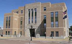
Lane County is a county located in the state of Kansas. Based on the 2010 census, the county population was 2,150, making it the third-least populous county in Kansas. Lane County was created on March 20, 1873. The county seat is Dighton. The county is named after James H. Lane who was a leader of the Jayhawker abolitionist movement and served as one of the first United States Senators from Kansas.
Etymology - Origin of Lane County Name
The county is named in honor of James H. Lane (1814-1866), a leader of the Free State forces in territorial Kansas and one of the first United States senators from the state.
Demographics:
County QuickFacts: CensusBureau Quick Facts
Lane County History
Lane County, in the western part of the state, is the fourth east from Colorado, and the fourth north from Oklahoma. It is bounded on the north by Gove county; on the east by Ness; on the south by Finney, and on the west by Scott. It was created by the legislature in 1873 and named for Senator
James H. Lane. The boundaries fixed at that time were as follows: "Commencing where the 3d standard parallel intersects the east line of range 27 west; thence south along range line to its intersection with the north line of township 20 south; thence west along township line to where it intersects
the east line of range 31 west; thence north along range line to its intersection with the 3d standard parallel; thence east to the place of beginning."
The first change in the boundaries was made in 1879, when the county was enlarged by township 15 in ranges 26 to 30. In 1881 it was diminished on the north by one tier of townships and increased on the south by a strip taken from Buffalo county. In 1883 townships 21 of ranges 27 to 30 were detached,
the first two being given to Hodgeman and the last two attached to Finney.
In Feb., 1886, in response to a petition from the residents of Lane county for organization Gov. Martin appointed G. T. Sutton census taker. His report, made on June 3, showed that there were 2,726 inhabitants, of whom 924 were householders, and $739,843 worth of taxable property, exclusive of
railroad property, of which $462,955 was real estate. Dighton was the choice of the majority of the voters for temporary county seat. The governor's proclamation, made the same day that this report was returned, declared Dighton the temporary county seat
Geography: Land and Water
As reported by the Census Bureau, the county has a total area of 718 square miles (1,860 km2), of which 717 square miles (1,860 km2) is land and 0.2 square miles (0.52 km2) (0.03%) is water.
Lane county is located in west Kansas. The county is rolling prairie. Bottom lands comprise about 8 per cent. of the area. A few small streams, flowing north and east, have their sources within the county. There is a little native timber. White limestone is found in the bluffs, and gypsum is plentiful.
Neighboring Counties
Bordering counties are as follows:
- Gove County (north)
- Ness County (east)
- Finney County (south)
- Scott County (west)
Education
Unified School Districts
Healy USD 468
Dighton USD 482


Click Image to Enlarge
