


Click Image to Enlarge
Kansas Counties
Kansas has one hundred and five counties. Originally 33 counties were organized by the Territorial Legislature in 1855. The Chase County Courthouse in Cottonwood Falls, Kansas was built in 1873 and is the oldest operating courthouse in Kansas. As of January 1, 2009 Greeley County and the city of Tribune unified to form the Unified Government of Greeley County..Lyon County, Kansas
Lyon County Education, Geography, and History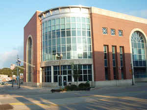
Lyon County is a county located in the state of Kansas. Based on the 2010 census, the county
population was
33,690. Breckinridge County was created on August 25,
1855. The County's name changed to Lyon County, on February 05,1862. The
county seat is Emporia. The county is
named for General Nathaniel Lyon, who was killed at the Battle of Wilson's
Creek in the Civil War.
Lyon County comprises the Emporia, KS Micropolitan Statistical Area.
Etymology - Origin of Lyon County Name
Named by the first Legislature, Breckenridge, in honor of John C. Breckenridge, United States Senator from Kentucky, and who became Vice-President of the United States in 1856. The county name changed to Lyon, in honor of General Nathaniel Lyon, who was killed while in command of the Union Army at the battle of Wilson's creek, Missouri, August 10, 1861.
Demographics:
County QuickFacts: CensusBureau Quick Facts
Lyon County History
Lyon County, created as Breckenridge county, by the first territorial legislature, was not organized until 1858, and did not assume its present boundaries until 1864. These boundaries are as follows: Wabaunsee county on the north; Osage and Coffey on the east; Greenwood on the south, and Chase and Morris on the west. In 1862, the former vice-president Breckenridge having become a secessionist, the patriotic anti-slavery legislature changed the name of the county to Lyon, in honor of Nathaniel Lyon, the Union general who had lost his life at Wilson's creek the previous August.
Geography: Land and Water
As reported by the Census Bureau, the county has a total area of 855 square miles (2,210 km2), of which 847 square miles (2,190 km2) is land and 7.9 square miles (20 km2) (0.9%) is water.
Lyon county is located in east Kansas. The county is prairie, with a few bluffs. The principal streams are the Neosho river, which runs across the county in a southeast direction; the Cottonwood river which crosses from west to east and joins the Neosho. Timber consist of oak, walnut, cottonwood, hickory, elm, hackberry, coffee-bean and locust. Magnesian limestone and sandstone are plentiful. Good quality of potter's clay is found between the Neosho and Cottonwood rivers.
Neighboring Counties
Bordering counties are as follows:
- Wabaunsee County, Kansas (north)
- Osage County, Kansas (northeast)
- Coffey County, Kansas (southeast)
- Greenwood County, Kansas (south)
- Chase County, Kansas (west)
- Morris County, Kansas (northwest)
Education
Unified School Districts
North Lyon County USD 251
Southern Lyon County USD 252
Emporia USD 253
Colleges and universities
Emporia State University
Flint Hills Technical College


Click Image to Enlarge
