


Click Image to Enlarge
Kansas Counties
Kansas has one hundred and five counties. Originally 33 counties were organized by the Territorial Legislature in 1855. The Chase County Courthouse in Cottonwood Falls, Kansas was built in 1873 and is the oldest operating courthouse in Kansas. As of January 1, 2009 Greeley County and the city of Tribune unified to form the Unified Government of Greeley County..Marshall County, Kansas
Marshall County Education, Geography, and History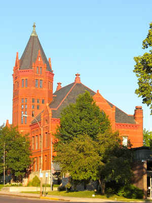
Marshall County is a county located in the state of Kansas. Based on the 2010 census, the county population was 10,117. Marshall County was created on August 25, 1855. The county seat is Marysville. The county is named in honor of Frank J. Marshall, member of the first territorial legislature, who operated a ferry on the Big Blue River at the Oregon Trail crossing.
Etymology - Origin of Marshall County Name
The county is named for General Frank J. Marshall, who established a ferry on the Big Blue at the crossing of the old Independence-California road in 1849. He was a prominent member of the first Legislature, and had his own name applied to the county. Marysville was declared the permanent county seat by the Legislature in 1860.
Demographics:
County QuickFacts: CensusBureau Quick Facts
Marshall County History
Marshall County, one of the original 33 counties created by the first territorial legislature, is located in the northern tier of counties. The act defining the boundaries is as follows: "Beginning at the northwest corner of Nemaha county, thence west on the boundary line 30 miles, thence south
30 miles, thence east 30 miles, thence north 30 miles to the place of beginning." By the act of Feb. 16, 1860, the county seat was permanently located at Marysville.
The history of Marshall county goes back to the expedition of Stephen H. Long, who passed through this territory in 1819 and 1820 on his way from Pittsburgh to the Rocky mountains. Gen. Fremont led a similar expedition through what is now Marshall county in the early '40s, and in 1847 John Smith,
the Mormon apostle, with his band of followers from Illinois opened a permanent trail crossing the Big Blue river 6 miles below the present city of Marysville, at a place afterward called "Mormon," for the reason that it became a camping place for these people, who during the next two years crossed
the plains by the thousands. In 1849 this trail was used by California gold hunters and the place was called "California crossing." Later it was known as Independence crossing. The first permanent settlement was made at this place by A. G. Woodward in 1848.
Marshall County was located on the
Oregon Trail, the Mormon Trail, and the route of the Pony Express. The Holladay
stage line from Atchison to Salt Lake City also passed though here. Frank J.
Marshall, a pioneer merchant, operated a tavern and a ferry across the Big Blue
river and Marysville is named for his wife Mary. He was a proslavery candidate
for governor in 1857.
Blue Rapids was the site of the first gypsum mine in Kansas, which opened in
1862. Gypsum is still mined and Georgia Pacific is a major employer.
A crowd of 3,000 watched the Chicago White Sox beat the New York Giants 8-5 in
an exhibition game in Blue Rapids on October 24, 1913. The field is still in
use; how many other cities have diamonds used by John McGraw, Jim Thorpe, and
Christy Mathewson.
Geography: Land and Water
As reported by the Census Bureau, the county has a total area of 905 square miles (2,340 km2), of which 900 square miles (2,300 km2) is land and 4.9 square miles (13 km2) (0.5%) is water.
Marshall county is located in northeast Kansas. The county is prairie, broken by hills and bluffs along the Blue river. Gypsum, limestone and coal are found in this county. Building stone is quarried out of the bluffs. The Big Blue river runs through the county from north to south, furnishing a water power unmatched elsewhere in the state. The Little Blue, one of its branches, enters near the central part of the west line of the county and empties into the Big Blue. The Black Vermillion flows through the southeastern part of the county.
Neighboring Counties
Bordering counties are as follows:
- Pawnee County, Nebraska (northeast)
- Nemaha County (east)
- Pottawatomie County (south)
- Riley County (southwest)
- Washington County (west)
- Gage County, Nebraska (northwest)
Education
Unified School Districts
Marysville USD 364
Vermillion USD 380
Valley Heights USD 498
Historical
Axtell USD 488 (Marshall County) and Sabetha USD 441 (Nemaha County) consolidated to create Prairie Hills USD 113.


Click Image to Enlarge
