


Click Image to Enlarge
Kansas Counties
Kansas has one hundred and five counties. Originally 33 counties were organized by the Territorial Legislature in 1855. The Chase County Courthouse in Cottonwood Falls, Kansas was built in 1873 and is the oldest operating courthouse in Kansas. As of January 1, 2009 Greeley County and the city of Tribune unified to form the Unified Government of Greeley County..Meade County, Kansas
Meade County Education, Geography, and History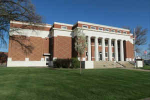
Meade County is a county located in the state of Kansas. Based on the 2010 census, the county population was 4,575. Meade county was created in 1873. The county seat is Meade. The county is named in honor of General George G. Meade.
Etymology - Origin of Meade County Name
The county is named in honor of Major-General George C. Meade, United States Army, who died in 1872.
Demographics:
County QuickFacts: CensusBureau Quick Facts
Meade County History
Meade County, one of the southern tier, is the fourth east from the
Colorado line. It is bounded on the north by Gray and Ford counties;
on the east by Clark; on the south by the State of Oklahoma, and on
the west by Seward and Haskell counties. It was created in 1873 and
named in honor of Gen. George G. Meade. The boundaries were defined
as follows: "Commencing at the intersection of the east line of range
27 west, with the north line of township 29 south; thence south along
range line to its intersection with the south boundary line of the State
of Kansas; thence west along said boundary line of the State of Kansas
to a point where it is intersected by the east line of range 31 west;
thence north along range line to where it intersects the north boundary
line of town 29 south; thence east to the place of beginning."
The county was dissolved in 1883, but was reestablished in 1885 with
slightly different boundaries. The northern boundary was made the north
line of township 30 south, and the east boundary was extended to the
east line of range 27 west, adding another tier of townships on the
east. The county was organized in 1885, when a petition signed by 250
householders attesting that the county had more than 1,500 inhabitants
and that more than 250 of these were householders, was sent to the governor,
John A. Martin. He appointed I. N. Graves census taker. The returns
showed a population of 3,507, of whom 1,165 were householders. The governor
made the proclamation of organization on Nov. 4. Meade Center was declared
the temporary county seat
Both the city and county were named for General George C. Meade (1815-1872),
the Union commander at Gettysburg.
O. E. Short and members of his government surveying team were killed
in Meade County by Cheyenne Indians in 1874. The six were buried under
a lone cottonwood tree that was a well-known trail landmark of the times.
The Chicago, Rock Island & Pacific R. R. enters in the northeast and crosses southwest through Meade into Seward county.
Geography: Land and Water
As reported by the Census Bureau, the county has a total area of 979 square miles (2,540 km2), of which 978 square miles (2,530 km2) is land and 1.3 square miles (3.4 km2) (0.1%) is water.
Meade county is located in southwest Kansas. The county is a rolling prairie with some rough lands and bluffs in the southeast. Timber is scarce. Crooked creek enters in the northeast, flows east about 10 miles to the southeast corner of the county.
Description
Meade County is part of the High Plains of Kansas: fairly flat and well suited to dry country farming. Early settlers seemed to think they had found the Garden of Eden:"If there is a more beautiful country than Meade Co. we know it not"Crooked Creek drains most of the county and the Cimarron River crosses the southwest corner. Highway US 54 follows the railroad diagonally across the the county leading southwest to Liberal. Highway US 160 crosses East/West and state highway K-23 runs North/South.The Call, Pearlette (Meade County), Kansas, August 15, 1879
Neighboring Counties
Bordering counties are as follows:
- Gray County (north)
- Ford County (northeast)
- Clark County (east)
- Beaver County, Oklahoma (south)
- Seward County (west)
- Haskell County (northwest)
Education
Unified School Districts
Fowler USD 225
Meade USD 226


Click Image to Enlarge
