


Click Image to Enlarge
Kansas Counties
Kansas has one hundred and five counties. Originally 33 counties were organized by the Territorial Legislature in 1855. The Chase County Courthouse in Cottonwood Falls, Kansas was built in 1873 and is the oldest operating courthouse in Kansas. As of January 1, 2009 Greeley County and the city of Tribune unified to form the Unified Government of Greeley County..Ottawa County, Kansas
Ottawa County Education, Geography, and History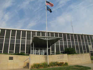
Ottawa County is a county located in the state of Kansas. Based on the 2010 census, the county population was 6,091. Ottawa County was created on February 27, 1860. The county seat is Minneapolis. The county is named for the Ottawa Native Americans, who lived in the area.
Etymology - Origin of Ottawa County Name
The county is named for the Ottawa Native Americans, who lived in the area.
Demographics:
County QuickFacts: CensusBureau Quick Facts
Ottawa County History
Ottawa County, named for the Ottawa tribe of Indians, is located on the west side of the 6th principal meridian and is the third county from the Nebraska line. It is bounded on the north by Cloud county; on the east by Clay; on the south by Saline, and on the west by Lincoln and Mitchell. The
extent of the county was described by the legislature of 1860 as including townships 9, 10, 11 and 12 south and ranges 1, 2, 3, 4 and 5 west. The legislature at that time named as commissioners R. C. Whitney, Henry Martin and a Mr. Branch. The county was formally organized in 1866 in response to a
petition from the citizens.
Minneapolis was the boyhood home of
the famous scientist George Washington Carver from 1880 to 1885.
Geography: Land and Water
As reported by the Census Bureau, the county has a total area of 721 square miles (1,870 km2), of which 721 square miles (1,870 km2) is land and 0.6 square miles (1.6 km2) (0.08%) is water.
Ottawa county is located close to the center of Kansas. The county is rolling prairie with rough lands along the divides and slopes leading down to the bottom lands. The principal stream is the Solomon river entering the county in the northwest part and flowing in a southeast direction. The Saline river crosses the southwest corner. The largest lake is Ottawa State Fishing Lake. Limestone, red sandstone, ocher, gypsum and potter's clay are abundant.
One of the geological interests of the state, known as the "City of Rocks," is located a short distance southwest of Minneapolis. At one time it consisted of several hundred round and oval shaped rocks, varying in size from 2 to 15 feet in diameter. The material is a white flinty sandstone in thin layers or scales.
Bordering counties are as follows:
- Cloud County (north)
- Clay County (northeast)
- Dickinson County (southeast)
- Saline County (south)
- Lincoln County (west)
- Mitchell County (northwest)
Education
Unified School Districts
North Ottawa County USD 239
Twin Valley USD 240


Click Image to Enlarge
