


Click Image to Enlarge
Kansas Counties
Kansas has one hundred and five counties. Originally 33 counties were organized by the Territorial Legislature in 1855. The Chase County Courthouse in Cottonwood Falls, Kansas was built in 1873 and is the oldest operating courthouse in Kansas. As of January 1, 2009 Greeley County and the city of Tribune unified to form the Unified Government of Greeley County..Pottawatomie County, Kansas
Pottawatomie County Education, Geography, and History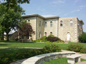
Pottawatomie County is a county located in the state of Kansas. Based on the 2010 census, the county
population was 21,604. Pottawatomie County was
created on February 20, 1857. The county
seat is Westmoreland. The county is named
in honor of Pottawatomie Native Americans, who lived in the area.
Pottawatomie County is part of the Manhattan, KS Metropolitan Statistical Area.
Etymology - Origin of Pottawatomie County Name
The county is named for the Pottawatomie Indians, whose reservation at the opening of the Kansas Territory for settlement, and for years afterward, embraced a large portion of the geographical area of the County.
Demographics:
County QuickFacts: CensusBureau Quick Facts
Pottawatomie County History
Pottawatomie County, formerly a part of Riley, was organized by the territorial legislature of 1857 with northern and southern boundaries the same as at present; the western boundary 5 miles east of the site of Manhattan, and the eastern boundary extending 5 miles beyond that of the present. The county is the second from Nebraska and the third west from Missouri. It is bounded on the north by Marshall and Nemaha counties; on the east by Jackson and Shawnee; on the south by Wabaunsee and Riley, and on the west by Riley. The Kaw river forms the southern boundary, and the Big Blue the western.
In Feb., 1857, after the founding of the new county, St. George was made the county seat
Louis Vieux, a Pottawatomie Indian, once operated the first ferry along the Oregon Trail to help travelers across the Vermillion River near Wamego
Geography: Land and Water
As reported by the Census Bureau, the county has a total area of 862 square miles (2,230 km2), of which 841 square miles (2,180 km2) is land and 21 square miles (54 km2) (2.4%) is water.
Pottawatomie county is located in northeast Kansas. The county is rolling, with bluffs along the Kansas and Big Blue rivers. Bottom lands make up one-fourth of the whole area. A good quality of gypsum is found along the water courses, especially at the mouth of Spring creek. Limestone is significantly quarried for building purposes. Potter's clay is found in the southern and central parts of the county. There are thin veins of coal in the east and south of the county. The Big Blue and the Kansas rivers, which form the western and southern boundaries and the Vermillion flows south through the eastern portion of the county.
Neighboring Counties
Bordering counties are as follows:
- Marshall County (north)
- Nemaha County (northeast)
- Jackson County (east)
- Shawnee County (southeast)
- Wabaunsee County (south)
- Riley County (west)
Education
Unified School Districts
The Unified School Districts that serve Pottawatomie County include:
Wamego USD 320 (Wamego, Louisville, Belvue)
Kaw Valley USD 321 (St. Marys, Emmett)
Onaga USD 322 (Onaga, Havensville, Wheaton)
Rock Creek USD 323 (Westmoreland, St. George)
Riley County USD 378 (West-Central Pottawatomie County)
Manhattan-Ogden USD 383 (Southwest Pottawatomie County)
Blue Valley USD 384 (Olsburg, Fostoria)
Private schools
St. Marys Academy & College(St. Marys)


Click Image to Enlarge
