Kansas Counties
Kansas has one hundred and five counties. Originally 33 counties were organized by the Territorial Legislature in 1855. The Chase County Courthouse in Cottonwood Falls, Kansas was built in 1873 and is the oldest operating courthouse in Kansas. As of January 1, 2009 Greeley County and the city of Tribune unified to form the Unified Government of Greeley County..Rawlins County, Kansas
Rawlins County Education, Geography, and History
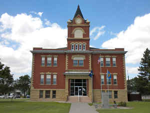
Rawlins County is a county located in the state of Kansas. Based on the 2010 census, the county population was 2,519. Rawlins County was created on March 20, 1873. The county seat is Atwood. Rawlins county is named after Union Civil War General John Aaron Rawlins.
Etymology - Origin of Rawlins County Name
The county is named in honor of General John A. Rawlins, who was a staff officer of General Grant, and went into his cabinet, when elected President, as Secretary of War.
Demographics:
County QuickFacts: CensusBureau Quick Facts
Rawlins County History
Rawlins County, one of the northern tier, is the 2d county east from the Colorado line. It is bounded on the north by the State of Nebraska; on the east by Decatur county; on the south by Thomas, and on the west by Cheyenne. This was one of the counties created by the legislature of 1873, and it was named in honor of Gen. John A. Rawlins, the United States secretary of war. The boundaries were defined as follows: "Commencing where the east line of range 31 west crosses the 40th degree of north latitude; thence south with range line to the 1st standard parallel; thence west with said parallel to the east line of range 37 west; thence north with said range line to the 40th degree of north latitude; thence east to the place of beginning."
County organization took place in May, 1881. Gov. St. John, in his proclamation, made Atwood the temporary county seat
General John A. Rawlins also served as Secretary of War in the Grant administration
Geography: Land and Water
As reported by the Census Bureau, the county has a total area of 1,070 square miles (2,800 km2), of which 1,069 square miles (2,770 km2) is land and 0.2 square miles (0.52 km2) (0.1%) is water.
Rawlins county is located in northwest Kansas. The county is rolling prairie, with a few bluffs. Two branches of Beaver creek enter the county in the southwest, flow northeast to the center where they join, forming one stream which continues northeast into Decatur county. The north and south forks of Sappa creek flow across the southeastern part. Timber and Burntwood creeks are in the northwest, and Driftwood in the northeast. Limestone, coal and sandstone are found in limited quantities. Springs are common in the valleys in this county.
Neighboring Counties
Bordering counties are as follows:
- Hitchcock County, Nebraska (north)
- Red Willow County, Nebraska (northeast)
- Decatur County (east)
- Thomas County (south)
- Sherman County (southwest)
- Cheyenne County (west)
- Dundy County, Nebraska (northwest)
Education
Unified School Districts
Rawlins County USD 105


