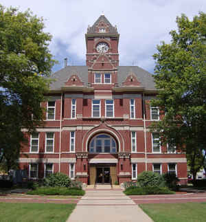
Kansas Counties
Kansas has one hundred and five counties. Originally 33 counties were organized by the Territorial Legislature in 1855. The Chase County Courthouse in Cottonwood Falls, Kansas was built in 1873 and is the oldest operating courthouse in Kansas. As of January 1, 2009 Greeley County and the city of Tribune unified to form the Unified Government of Greeley County..Rice County, Kansas
Rice County Education, Geography, and History
Rice County is a county located in the state of Kansas. Based on the 2010 census, the county population was 10,083. Rice County was created on February 26, 1867. The county seat is Lyons. The county is named for of Samuel Allen Rice, Brigadier-General, United States volunteers, killed April 30, 1864, at Jenkins Ferry, Arkansas
Etymology - Origin of Rice County Name
The county is named for Samuel A. Rice, Brigadier-General, United States volunteers, killed April 30, 1864 at Jenkins Ferry, Arkansas.
Demographics:
County QuickFacts: CensusBureau Quick Facts
Rice County History
Rice County, in the central part of the state, is in the second tier of counties west of the 6th principal meridian, and in the fourth tier north of the Oklahoma line. It is bounded on the north by Ellsworth county; on the east by McPherson; on the south by Reno, and on the west by Stafford and
Barton. It is crossed a little to the west of the center by the 1st guide meridian west. It was named in honor of Brig.-Gen. Samuel A. Rice, of the United States volunteers, who was killed at Jenkins' Ferry, Ark., April 30, 1864.
Although Rice county was created and its boundary lines fixed by the legislature of 1867, it was not until 1870 that it was settled.
Geography: Land and Water
As reported by the Census Bureau, the county has a total area of 728 square miles (1,890 km2), of which 726 square miles (1,880 km2) is land and 1.7 square miles (4.4 km2) (0.2%) is water.
Rice county is located close to the center of Kansas. The western portion of the county is nearly level and the central and eastern parts rather rolling. Limestone is found in the northeast and the southeast; sandstone in the northeast and near Raymond in the southwest; red ochre is in the northeast; there are beds of gypsum in the southeast; huge beds of salt underlie the county, and the finished product is manufactured at Lyons and Sterling. Bottom lands make up approximately 15 per cent of the area. Timber consist of cottonwood, elm, hackberry and oak.
Neighboring Counties
Bordering counties are as follows:
- Ellsworth County (north)
- McPherson County (east)
- Reno County (south)
- Stafford County (southwest)
- Barton County (northwest)
Education
Unified School Districts
USD 328, Lorraine, serves Bushton and northwestern areas of the county
USD 376, Sterling
USD 401, Chase
USD 405, Lyons
USD 444, Little River
Colleges and Universities
Sterling College, private four year institution affiliated with the Presbyterian Church, USA, is located in Sterling.


