


Click Image to Enlarge
Kansas Counties
Kansas has one hundred and five counties. Originally 33 counties were organized by the Territorial Legislature in 1855. The Chase County Courthouse in Cottonwood Falls, Kansas was built in 1873 and is the oldest operating courthouse in Kansas. As of January 1, 2009 Greeley County and the city of Tribune unified to form the Unified Government of Greeley County..Sherman County, Kansas
Sherman County Education, Geography, and History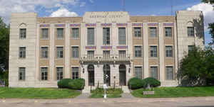
Sherman County is a county located in the state of Kansas. Based on the 2010 census, the county population was 6,010. Sherman County was created by the Legislature of 1873. The county seat is Goodland. The county is named after General William Tecumseh Sherman.
Etymology - Origin of Sherman County Name
The county is named for General William Tecumseh Sherman, (1820-1891), prominent Union Civil War general, most famous for his scorched-earth tactics during the Civil War, during the march from Atlanta to the sea. As general commander of the United States Army after 1869, he asserted that the aim of Indian policy should be to place the tribes on reservations and make them stay there, and he directed the campaigns through the 1870s that put this policy into practice.
Demographics:
County QuickFacts: CensusBureau Quick Facts
Sherman County History
Sherman County, one of the western tier, the second south from Nebraska, is bounded on the north by Cheyenne county; on the east by Thomas; on the south by Wallace and Logan, and on the west by the State of Colorado. It was created in 1873 and named for Gen. William T. Sherman. The boundaries
were defined as follows: "Commencing where the east line of range 37 west intersects the 1st standard parallel; thence south with said line to the 2nd standard parallel; thence west with said parallel to the west line of the State of Kansas; thence north on said line to the 1st standard parallel;
thence east on said parallel to the place of beginning."
William Tecumseh Sherman (1820-1891)
was a Union general during the Civil War who lead the famous march across
Georgia and is credited with the saying "War is Hell".
Sherman County is one of only four Kansas counties to observe Mountain Standard Time. Since Sherman County is part of the Wichita media market and the local broadcast stations are repeat signals of Wichita affiliates, prime-time programming in the county is aired from 6 to 9 p.m. local time, rather than 7 to 10 p.m. as is normal in the Central and Mountain time zones. However, cable providers carry the ABC and NBC affiliates from both Wichita and Denver, affording viewers the opportunity to view programs on those networks at the normal prime-time hours.
Geography: Land and Water
As reported by the Census Bureau, the county has a total area of 1,056 square miles (2,740 km2), of which 1,056 square miles (2,740 km2)
is land and 0.2 square miles (0.52 km2) (0.02%) is water.
Sherman county is located in west Kansas. The county rolling prairie, with a few bluffs and some rough lands along Beaver creek. Lamborn is the highest point in the state
and its altitude is 3,906 feet. Native timber is scarce. The north fork of the Smoky Hill enters near the southwest corner and flows across the southern portion into Wallace county. The north and middle forks of the Sappa have their source in the central part of the county and flow
northeast across the eastern boundary. Beaver and Little Beaver creeks rise in the northern part and flow north into Cheyenne county. Limestone is found in the southwest.
Neighboring Counties
Bordering counties are as follows:
- Cheyenne County (north)
- Rawlins County (northeast)
- Thomas County (east)
- Logan County (southeast)
- Wallace County (south)
- Kit Carson County, Colorado (west)
Education
Unified School Districts
Brewster USD 314
Goodland USD 352


Click Image to Enlarge
