


Click Image to Enlarge
Kansas Counties
Kansas has one hundred and five counties. Originally 33 counties were organized by the Territorial Legislature in 1855. The Chase County Courthouse in Cottonwood Falls, Kansas was built in 1873 and is the oldest operating courthouse in Kansas. As of January 1, 2009 Greeley County and the city of Tribune unified to form the Unified Government of Greeley County..Stanton County, Kansas
Stanton County Education, Geography, and History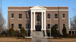
Stanton County is a county located in the state of Kansas. Based on the 2010 census, the county population was 2,235. Stanton County was created on March 20, 1873. The county seat is Johnson City. The county is named in honor of Edwin McMasters Stanton (1814-1869), Secretary of War from 1862 to 1868.
Etymology - Origin of Stanton County Name
This county is named for Edward McMasters Stanton (1814-1869), Secretary of war under President Lincoln.
Demographics:
County QuickFacts: CensusBureau Quick Facts
Stanton County History
Stanton County, in the western tier, is the second county north from the Oklahoma line. It is bounded on the north by Hamilton county; on the east by Grant; on the south by Morton, and on the west by the State of Colorado. It was first created in 1873 and was named in honor of Edwin M. Stanton,
former secretary of war. The boundaries were defined as follows: "Commencing at the intersection of the east line of range 39 west with the north line of town 27 south; thence south along range line to its intersection with the 6th standard parallel; thence west along the 6th standard parallel to
the west boundary line of the State of Kansas; thence north along said west boundary line of the State of Kansas to where it is intersected by the north line of township 27 south; thence east to the place of beginning."
Later the county was obliterated and the territory became a part of Hamilton, remaining so until Feb., 1887, when the original lines were restored. Meantime the lands had been settled and towns established. In May, 1887, W. A. Cotterman was appointed census taker. As he went over the county making
the enumeration he took a vote on which town should he recommended to the governor as the temporary county seat. A large majority was in favor of Johnson City and Gov. John A. Martin in his proclamation of June 17 designated that place as the temporary county seat.
Geography: Land and Water
As reported by the Census Bureau, the county has a total area of 680 square miles (1,800 km2), of which 680 square miles (1,800 km2) is land and 0.07 square miles (0.18 km2) (0.01%) is water.
Stanton county is located in west Kansas. The county is generally level prairie. Bear creek enters in the west from Colorado and flows northeast into Grant county. The north fork of the Cimarron flows across the southeast corner. Gypsum and magnesian limestone are found in abundance.
Neighboring Counties
Bordering counties are as follows:
- Hamilton County (north)
- Kearny County (northeast)
- Grant County (east)
- Stevens County (southeast)
- Morton County (south)
- Baca County, Colorado (west)
- Prowers County, Colorado (northwest)
Education
Unified School Districts
Stanton County USD 452


Click Image to Enlarge
