


Click Image to Enlarge
Kansas Counties
Kansas has one hundred and five counties. Originally 33 counties were organized by the Territorial Legislature in 1855. The Chase County Courthouse in Cottonwood Falls, Kansas was built in 1873 and is the oldest operating courthouse in Kansas. As of January 1, 2009 Greeley County and the city of Tribune unified to form the Unified Government of Greeley County..Wyandotte County, Kansas
Wyandotte County Education, Geography, and History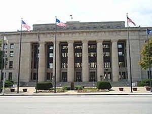
Wyandotte County is a county located in the state of Kansas. Based on the 2010 census, the
population was 157,505. Wyandotte County was
created on January 29, 1859. The county
seat is Kansas City.
The county is named for the Wyandotte Native Americans,
who lived in the area.
Wyandotte County lies immediately west of Kansas City, Missouri and is included in the Kansas City, MO-KS Metropolitan Statistical Area.
Etymology - Origin of Wyandotte County Name
The county is named for the Wyandotte Native Americans, who lived in the area.
Demographics:
County QuickFacts: CensusBureau Quick Facts
Wyandotte County History
Wyandotte County, located in the extreme eastern part of the state, was formed from the southeastern part of Leavenworth county by an act of the legislature of Jan. 29, 1859, with the following boundaries: "Commencing at a point in the middle of the channel of the Missouri river, where the north
line of the Delaware reserve intersects the same, running thence west, on said reserve line, to the line between ranges 22 and 23; thence south on said range line, to the south boundary of Leavenworth county; thence easterly, on said boundary, to the middle of the main channel of the Missouri river;
thence northwesterly, with said main channel, to the place of beginning; also that portion of Johnson county, lying north of the township line between townships 11 and 12, east of range 23."
Wyandotte is the smallest county in the state, having an area of only 153 square miles. It is triangular in shape, being bounded on the north by Leavenworth county and the Missouri river; on the east by the Missouri river; on the south by Johnson county, and on the west by Leavenworth county. It was
named in memory of the Wyandotte Indians.
Geography: Land and Water
As reported by the Census Bureau, the county has a total area of 156 square miles (400 km2), of which 152 square miles (390 km2) is land and 4.6 square miles (12 km2) (2.9%) is water. It is the smallest county by area in Kansas.
Wyandotte county is located in east Kansas. The country is rolling, marked by high bluffs along the Kansas and Missouri rivers. Timber consist of cottonwood, hickory, oak, walnut and other varieties of trees native to Kansas. The main water course is the Missouri river, and the next stream of importance is the Kansas river, which forms a part of the southern boundary, and then flowing northeast empties into the Missouri river at Kansas City. Limestone, sandstone, fire clay and cement rock are found in substantial quantities. Coal is mined for commercial purposes. The soil is a rich sandy loam, especially well adapted to fruit raising.
Neighboring Counties
Bordering counties are as follows:
- Platte County, Missouri (north)
- Clay County, Missouri (northeast)
- Jackson County, Missouri (east)
- Johnson County (south)
- Leavenworth County (west)
Education
Colleges and universities
Public
Kansas City Kansas Community College
University of Kansas Medical Center
Private
Donnelly College
School Districts
Turner USD 202
Piper USD 203
Bonner Springs USD 204
Kansas City USD 500
Private schools
Primary
Resurrection Grade School (formerly St. Peter's Cathedral Grade School)
St. Patrick's Grade School
Christ the King Grade School
Secondary
Bishop Ward High School
Other schools
Kansas State School for the Blind (KSSB)


Click Image to Enlarge
