


Click Image to Enlarge
Kentucky Counties
Kentucky has one hundred and twenty counties, third in the US behind Texas's (254) and Georgia's (159.) Washington County was the first county formed in the Commonwealth of Kentucky when it reached statehood, and the sixteenth county formedBourbon County, Kentucky
Bourbon County Education, Geography, and History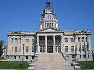
Bourbon County is a county located in the state of Kentucky. Based on the 2010 census, the
population was 19,985. Bourbon County was
created on October 17, 1785. The county
seat is
Paris. The county is named for the House of Bourbon,
European royal house.
Bourbon County is part of the Lexington-Fayette, KY Metropolitan Statistical Area.
Etymology - Origin of Bourbon County Name
As a tribute to their overseas aid during the Revolutionary War, Bourbon County was named after the French royal family.
Demographics:
County QuickFacts: CensusBureau Quick Facts
Bourbon County History
Old Bourbon
In 1780, Kentucky County, Virginia, was divided into three counties of Virginia: Fayette, Jefferson, and Lincoln, called the District of Kentucky.
Bourbon County is the remnant of what was previously a much larger Bourbon County, established as part of Virginia in 1785, and comprising what are now thirty-four modern Kentucky counties. The area later became known as Old Bourbon in reference to its historical expanse. It was originally part of the French province of Louisiana, then after 1763 became part of Virginia, but was transferred to the newly formed Commonwealth of Kentucky in 1792.
Bourbon county was formed in 1786. It is located in the Inner Bluegrass region of the state. The elevation in the county ranges from 715 to 1050 feet above sea level. In 2000 the county population was 19,360 in a land area of 291.43 square miles, an average of 66.4 people per square mile. The county seat is Paris.
The county is best known for its historical association with bourbon whiskey.
Notable people
David Dick, CBS News correspondent who retired to Bourbon County
Geography: Land and Water
As reported by the Census Bureau, the county has a total area of 292 square miles (760 km2), of which 290 square miles (750 km2) is land
and 1.9 square miles (4.9 km2) (0.6%) is water.
Bourbon county is located close to the center of Kentucky.
There are no large lakes in the county, but there are several streams.
The main stream is Stoner Creek, on which the county seat is
located. This large stream is a main branch of the South Fork of the Licking River.
The county's landscape is mainly gently rolling hills.
Neighboring Counties
Bordering counties are as follows:
- Northeast: Nicholas County
- East: Bath County
- Southeast: Montgomery County
- South: Clark County
- Southwest: Fayette County
- Northwest: Scott County; Harrison County
Education


Click Image to Enlarge
