


Click Image to Enlarge
Kentucky Counties
Kentucky has one hundred and twenty counties, third in the US behind Texas's (254) and Georgia's (159.) Washington County was the first county formed in the Commonwealth of Kentucky when it reached statehood, and the sixteenth county formedBullitt County, Kentucky
Bullitt County Education, Geography, and History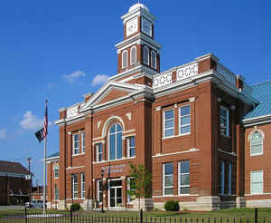
Bullitt County is a county in the state of Kentucky located in the far western Bluegrass region known as the Knobs. Based on the 2010 census, the
population was 74,319. The county was created in 1796.
The county seat is Shepherdsville. The
county is named for Alexander Scott Bullitt, Lieutenant
Governor of Kentucky (1800–1804).
Located just south of the city of Louisville, Bullitt County is included in the Louisville/Jefferson County, KY-IN Metropolitan Statistical
Area, commonly known as Kentuckiana.
Etymology - Origin of Bullitt County Name
The county is named for Alexander Scott Bullitt (1762-1816), helped draft Kentucky's first constitution; first president of the Kentucky Senate; first Lieutenant Governor.
Demographics:
County QuickFacts: CensusBureau Quick Facts
Bullitt County History
The first inhabitants of the land that would become Bullitt County were the Paleo-Indians who entered North America approximately 11,500 to
10,000 years BP. These people, whose ancestors can be traced back to Eastern and Central Asia, were nomadic. They were hunters and gatherers
whose remains have been discovered near the area's mineral springs or salt licks, where big game such as the mammoth, bison and ground sloth
once gathered. Native Americans were their descendants, including the Shawnee people, who probably considered this region part of their
homeland and certainly valued it as a hunting ground.
Both France and Britain had traders and colonists who encountered the Shawnee. European colonization of the Americas led to competing claims
between those nations to the lands west of the Appalachians and east of the Mississippi River. After suffering defeat by Great Britain in the
Seven Years' War (known as the French and Indian War in its North American front), France ceded control in 1763 of its claimed territories.
For thousands of years before the county's formation, nutrient-rich salt licks attracted large herds of bison and other game to the area.
Native American tribes made it their hunting grounds, as did the 18th century longhunter. In 1773, after the French and Indian War, the
Virginia governor sent Captain Thomas Bullitt (uncle to Alexander Scott Bullitt) into the area to survey for land grants. The most historic of
the county's salt licks, Bullitt's Lick, is named after him. As the Revolutionary War led to widespread salt shortages, the Lick became the
site of Kentucky's first industry, attracting many settlers to the area.
Colonial veterans of the war were promised land in what was later called Kentucky. Bullitt's Lick became an important saltwork to the region;
its salt was harvested and sent by pack train and flatboat as far off as Illinois to the west. The Bullitt's Lick saltwork was Kentucky's
first industry and in production until around 1830. By that time, the steamboat and importing of salt brought access to less expensive
sources.
The first settlement of the area was also the first station on the Wilderness Road between Harrodsburg and the Falls of the Ohio. It was a
fort called Brashear's Station or the Salt River Garrison, built in 1779 at the mouth of Floyd's Fork. Most of the county was settled after
the American Revolutionary War. Shepherdsville, named after Adam Shepherd, a prosperous business man who purchased the land near the Falls of
Salt River in 1793, is the oldest town and became the county seat
In December of 1796 the county of Bullitt, named after Thomas Bullitt's nephew and Kentucky's first Lieutenant Governor Alexander Scott Bullitt, was organized from land taken from Jefferson and Nelson counties through an act approved on December 13, 1796 by the Kentucky General Assembly. In 1811, the northwestern area of the county expanded to include land given by Jefferson County. In 1824, an eastern area of the county was given to help form Spencer County.
It is located in the Western Knobs region of the state. The elevation in the county ranges from 385 to 998 feet above sea level. In 2000 the county population was 61,236 in a land area of 299.08 square miles, an average of 204.7 people per square mile. The county seat is Shepherdsville.
Geography: Land and Water
As reported by the Census Bureau, the county has a total area of 300 square miles (780 km2), of which 297 square miles (770 km2) is land and 3.2 square miles (8.3 km2) (1.1%) is water.
Bullitt county is located close to the center of Kentucky. The county’s 300 square miles overlap the outer Bluegrass and the Knobs regions of Kentucky.
Neighboring Counties
Bordering counties are as follows:
- North: Jefferson County
- East: Spencer County
- Southeast: Nelson County
- Southwest: Hardin County
Education
Bullitt County is served by Bullitt County Public Schools.
There are six middle schools:
Bernheim Middle School
Bullitt Lick Middle School
Eastside Middle School
Hebron Middle School
Mount Washington Middle School
Zoneton Middle School
There are four high schools:
Bullitt Central High School, located in Shepherdsville
Bullitt East High School, located in Mount Washington
North Bullitt High School, located in Hebron Estates (served by the Shepherdsville post office)
Riverview High School


Click Image to Enlarge
