


Click Image to Enlarge
Kentucky Counties
Kentucky has one hundred and twenty counties, third in the US behind Texas's (254) and Georgia's (159.) Washington County was the first county formed in the Commonwealth of Kentucky when it reached statehood, and the sixteenth county formedFloyd County, Kentucky
Floyd County Education, Geography, and History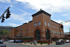
Floyd County is a county located in the state of Kentucky. Based on the 2010 census, the population was 39,451. Floyd County was created on June 1, 1800. The county seat is Prestonsburg. The county is named in honor of Colonel John Floyd (1750–1783), surveyor, pioneer and military leader of Jefferson County.
Etymology - Origin of Floyd County Name
Floyd county is named for Colonel John Floyd (1750-1783), pioneer, surveyor and military leader of Jefferson County.
Demographics:
County QuickFacts: CensusBureau Quick Facts
Floyd County History
On December 13, 1799, the Kentucky General Assembly passed legislation to form Floyd County as the 40th county of Kentucky. The county was made from parts of Fleming, Montgomery, and Mason County, Kentucky. The legislation became effective on June 1, 1800. It is located in the Eastern Coal Field region of the state. The elevation in the county ranges from 580 to 2320 feet above sea level. In 2000 the county population was 42,441 in a land area of 394.29 square miles, an average of 107.6 people per square mile. The county seat is Prestonsburg.
Geography: Land and Water
As reported by the Census Bureau, the county has a total area of 396 square miles (1,030 km2), of which 393 square miles (1,020 km2) is land and 2.4 square miles (6.2 km2) (0.6%) is water.
Floyd county is located in east Kentucky. Floyd county is located in the coal, oil and natural gas fields of Kentucky. This county is part of the Cumberland Plateau of the Appalachian Mountain range. It is drained by the Louisa Fork of the Big Sandy River and has elevation ranges of 641 feet above sea level to over 2000 feet on higher peaks.
Neighboring Counties
Bordering counties are as follows:
- North: Johnson County
- Northeast: Martin County
- Southeast: Pike County
- Southwest: Knott County
- Northwest: Magoffin County
Education
The county's public schools are operated by the Floyd County School District


Click Image to Enlarge
