


Click Image to Enlarge
Kentucky Counties
Kentucky has one hundred and twenty counties, third in the US behind Texas's (254) and Georgia's (159.) Washington County was the first county formed in the Commonwealth of Kentucky when it reached statehood, and the sixteenth county formedFulton County, Kentucky
Fulton County Education, Geography, and History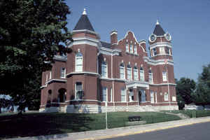
Fulton County is the westernmost county of the state of Kentucky, with its western boundary the Mississippi River. Based on the 2010 census, the population was 6,813. Fulton County was created on January 15, 1845. The county seat is Hickman. The county is named in honor of Robert Fulton (1765–1815), inventor of the first commercially successful steamboat.
Fulton County is part of the Union City, TN-KY Micropolitan Statistical Area, which is included in the Martin-Union City, TN-KY Combined Statistical Area.
Etymology - Origin of Fulton County Name
Fulton county is named for Robert Fulton (1765-1815), artist and inventor of the 1st commercially successful steamboat.
Demographics:
County QuickFacts: CensusBureau Quick Facts
Fulton County History
Fulton County residents were largely pro-Confederate during the American Civil War. Forces from both armies passed through the county during different periods of the conflict. Because of imprecise early surveying of Kentucky's southern border, Fulton County is divided into two non-contiguous parts. An exclave on the peninsula in the Kentucky Bend of the Mississippi River can be reached only by road through Tennessee.
Fulton county was formed in 1845. It is located in the Jackson Purchase region of the state. The elevation in the county ranges from 260, the lowest in the state, to 500 feet above sea level. In 2000 the county population was 7,752 in a land area of 208.95 square miles, an average of 37.1 people per square mile. The county seat is Hickman.
About 11 square miles (28 km2) of the county is separated in a peninsula from the rest of the state by an oxbow of the Mississippi River, known as the Kentucky Bend or New Madrid Bend, after the city in Missouri on the north side of the river. Travelers going there have to pass into Tennessee by road (there is no bridge from Missouri) and then go north to reach the Kentucky Bend exclave. The lowest point in the state of Kentucky is located on the Mississippi River in Kentucky Bend in Fulton County, where it flows past Kentucky and between Tennessee and Missouri. It is expected that over time, the river will cut across the short neck of the peninsula, cutting it off entirely from Kentucky, with land gradually filling in behind it to connect it to Missouri.
Geography: Land and Water
As reported by the Census Bureau, the county has a total area of 231 square miles (600 km2), of which 206 square miles (530 km2) is land and 25 square miles (65 km2) (11%) is water.
Fulton county is located in west Kentucky. Part of the Reelfoot
National Wildlife Refuge is located in this county. This county is
located on the Mississippi River. The elevation in the county ranges
from 260 feet, the lowest in the state, to 500 feet above sea level.
Neighboring Counties
Bordering counties are as follows:
- Northeast: Hickman County
- South: Obion County, Tenn.
- Southwest: Lake County, Tenn.
- West: New Madrid County, Mo.
- Northwest: Mississippi County, Mo.
Education
Fulton County School District
Fulton Independent Schools


Click Image to Enlarge
