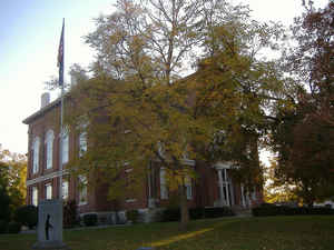
Hickman County, Kentucky
Hickman County Education, Geography, and History
Hickman County is a county located in the state of Kentucky. Based on the 2010 census, the population was 4,902. Hickman County was created on December 19, 1821. The county seat is Clinton. Hickman county is named for Captain Paschal Hickman of the 1st Rifle Regiment, Kentucky Militia.
Etymology - Origin of Hickman County Name
Hickman county is named for Captain Paschal Hickman of the 1st Rifle Regiment, Kentucky Militia. A resident of Franklin County, Kentucky, Hickman was wounded and captured at the Battle of Frenchtown in January 1813 and was killed by Indians in the Massacre of the River Raisin.
Demographics:
County QuickFacts: CensusBureau Quick Facts
Hickman County History
Founded in 1821, Hickman County was the seventy-first in order of formation. It is located in the Jackson Purchase region of the state. The county seat is Clinton. It is the least densely populated county in the state and is a prohibition or dry county.
Geography: Land and Water
As reported by the Census Bureau, the county has a total area of 253 square miles (660 km2), of which 242 square miles (630 km2) is land and 11 square miles (28 km2) (4.3%) is water. The elevation in the county ranges from 276 feet (84 m) to 510 feet (160 m) above sea level. The elevation in the county ranges from 276 to 510 feet above sea level. In 2000 the county population was 5,262 in a land area of 244.44 square miles, an average of 21.5 people per square mile.
Hickman county is located in west Kentucky. The county's western border with Missouri is formed by the Mississippi River. The general surface of the country is slightly rolling. The Neosho River flows through the western part of the county from north to south. The Marmaton River is in the center of the county and flows through the southeastern part of the county. The Little Osage River flows northeast.
Neighboring Counties
Bordering counties are as follows:
- North: Carlisle County
- East: Graves County
- Southeast: Weakley County, Tenn.
- Southwest: Obion County, Tenn.; Fulton County
- Northwest: Mississippi County, Mo.
Education


