


Click Image to Enlarge
Kentucky Counties
Kentucky has one hundred and twenty counties, third in the US behind Texas's (254) and Georgia's (159.) Washington County was the first county formed in the Commonwealth of Kentucky when it reached statehood, and the sixteenth county formedJohnson County, Kentucky
Johnson County Education, Geography, and History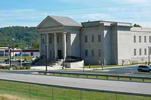
Johnson County is a county located in the state of Kentucky. Based on the 2010 census, the population was 23,356. Johnson County was created on February 24, 1843. The county seat is Paintsville. Johnson county is named for Richard Mentor Johnson, War of 1812 general, United States Representative, Senator, and Vice President of the United States.
Etymology - Origin of Johnson County Name
Johnson county is named for General Richard M. Johnson (1780-1850), hero of the War of 1812, a United States House of Representative, Senator and a United States Vice President.
Demographics:
County QuickFacts: CensusBureau Quick Facts
Johnson County History
Johnson County was formed in 1843 from land given by Floyd County. At that time, its county seat of Paintsville had already been a chartered city for nine years. Homes had been built in Paintsville as early as the 1810s.
This county is located in the Eastern Coal Field region of the state. The county seat is Paintsville.
Johnson County is classified as a moist county, which is a county in which alcohol sales are not allowed (a dry county), but containing a "wet" city, in this case Paintsville, where alcoholic beverage sales are allowed.
Geography: Land and Water
As reported by the Census Bureau, the county has a total area of 264 square miles (680 km2), of which 262 square miles (680 km2) is land and 2.2 square miles (5.7 km2) (0.8%) is water. The elevation in the county ranges from 550 to 1508 feet above sea level. In 2000 the county population was 23,445 in a land area of 261.54 square miles, an average of 89.6 people per square mile. The county's highest point is Stuffley Knob, with an elevation of 1,496 feet (456 m). The county's lowest point is the Levisa Fork on the Lawrence County border, with an elevation of about 550 feet (168 m).
Johnson county is located in east Kentucky.
Neighboring Counties
Bordering counties are as follows:
- Northeast: Lawrence County
- East: Martin County
- South: Floyd County
- Southwest: Magoffin County
- West: Morgan County
Education
Public
Johnson County is home to two public school districts:
Johnson County Schools
Paintsville Independent Schools
Private
Big Sandy Community and Technical College
Two private schools also operate in the county: Our Lady of the Mountain School (K-8) and Johnson County Christian School.
Colleges
Big Sandy Community and Technical College manages two campuses in Johnson County: Mayo and Hager Hill.


Click Image to Enlarge
