


Click Image to Enlarge
Kentucky Counties
Kentucky has one hundred and twenty counties, third in the US behind Texas's (254) and Georgia's (159.) Washington County was the first county formed in the Commonwealth of Kentucky when it reached statehood, and the sixteenth county formedLaurel County, Kentucky
Laurel County Education, Geography, and History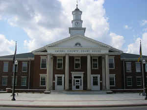
Laurel County is a county in the state of Kentucky. Based on the 2010 census, the population was 58,849. Laurel County was created on December 21, 1825. The county seat is London. There is no definite name origin known. The county could be named after the mountain laurel or the Laurel River.
Laurel County is included in the London, KY Micropolitan Statistical Area.
Etymology - Origin of Laurel County Name
No definite origin known, historians attribute Laurel County to be named for the immense growth of mountain laurel and rhododendron shrubs in the area, or the county is named after the Laurel River.
Demographics:
County QuickFacts: CensusBureau Quick Facts
Laurel County History
Laurel County, the 80th county to be organized in Kentucky, was established by an act of the general assembly, December 21, 1825, from parts of Rockcastle, Clay, Knox and Whitley Counties. It is located in the Eastern Coal Field region of the state. The elevation in the county ranges from 723 to 1760 feet above sea level. In 2000 the county population was 52,715 in a land area of 435.67 square miles, an average of 121.0 people per square mile. The county seat is London.
Laurel County was the location of the Battle of Wildcat Mountain, a pivotal yet little known battle during the American Civil War that kept
Confederate armies from advancing on Big Hill, a major stronghold during the war.
After a fire damaged the courthouse in 1958, a new structure was completed in 1961.
Geography: Land and Water
As reported by the Census Bureau, the county has a total area of 444 square miles (1,150 km2), of which 434 square miles (1,120 km2) is land and 9.7 square miles (25 km2) (2.2%) is water.
Laurel county is located close to the center of Kentucky. Cumberland Falls and the Big South Fork are located in this county. Part of the Daniel Boone National Forest is located in this county.
Neighboring Counties
Bordering counties are as follows:
- Northeast: Jackson County
- East: Clay County
- Southeast: Knox County
- South: Whitley County
- Southwest: McCreary County
- West: Pulaski County
- Northwest: Rockcastle County
Education
Two public school districts serve K-12 students in the county:
Laurel County School District - Operates one preschool, 11 elementary schools, two middle schools, and two high schools.
East Bernstadt Independent School District - Operates a single K-8 school. High school students in the district may attend either high school
in the Laurel County district.


Click Image to Enlarge
