


Click Image to Enlarge
Kentucky Counties
Kentucky has one hundred and twenty counties, third in the US behind Texas's (254) and Georgia's (159.) Washington County was the first county formed in the Commonwealth of Kentucky when it reached statehood, and the sixteenth county formedMcCreary County, Kentucky
McCreary County Education, Geography, and History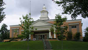
McCreary County is a county located in the state of Kentucky. Based on the 2010 census, the population was 18,306. McCreary County was created on March 12, 1912. The county seat is Whitley City. The county is named for James B. McCreary, a Confederate war hero.
Etymology - Origin of McCreary County Name
McCreary county is named for James B. McCreary (1838-1918), lawyer, Confederate officer, Kentucky senator, representative, and Governor of Kentucky from 1875 to 1879, and 1911 to 1915. During his second term as Governor of Kentucky, McCreary County was named in his honor.
Demographics:
County QuickFacts: CensusBureau Quick Facts
McCreary County History
McCreary County was formed on March 12, 1912, the 120th and final county in order of formation. The present county boundaries contain 427.7 square miles (1,107.7 km2) of land area. The majority of the county was carved out of Wayne and Whitley Counties, with a large center strip following the rail line and roadway from Pulaski County, and a northeastern portion taken from Laurel County. The early history of the area is that of those counties, and is related in the historic perspectives for them. The map to the left shows the network of roadways that had been established by the 1860s. A dotted blue line and settlement names have been added for reference. During the Civil War, the region was the scenario of heavy fighting between Union and Confederate forces fighting for control of Fort Donelsen, and as part of the Union effort to secure the Cumberland. The fall of Fort Donelsen culminated in the eventual capture of Nashville
It is located in the Eastern Coal Field region of the state. In 2000 the county population was 17,080 in a land area of 427.70 square miles, an average of 39.9 people per square mile. The county seat is Whitley City. McCreary county is entirely within the Daniel Boone National Forest and includes the Big South Fork National River and Recreation Area. It is the last county formed in the state.
Geography: Land and Water
As reported by the Census Bureau, the county has a total area of 431 square miles (1,120 km2), of which 427 square miles (1,110 km2) is
land and 4.1 square miles (11 km2) (1.0%) is water.
McCreary county is located close to the center of Kentucky.
The western boundary of McCreary County represents the division between two geological plateau systems, the Pennyroyal and the Cumberland.
This county is located in the Daniel Boone National Forest.
Among the more remarkable features are the sheer cliffs themselves, and numerous gorges, waterfalls, rock shelters, and natural stone arches.
Two of the best known sections of the cliffs in Kentucky are the Red River Gorge Geological Area and the Natural Bridge State Park in the
north-central portion of the Daniel Boone National Forest.
The terrain is abruptly divided by valleys and stream systems, and
limited lands suitable for large-scale usual agriculture exist. The
elevation in the county ranges from 723 to 2165 feet above sea level.
Neighboring Counties
Bordering counties are as follows:
- North: Pulaski County
- Northeast: Laurel County
- East: Whitley County
- South: Scott County, Tenn.
- Northwest: Wayne County
Education


Click Image to Enlarge
