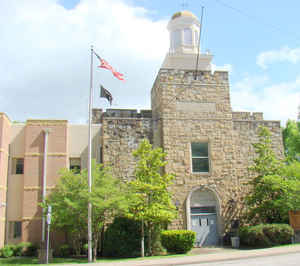
Menifee County, Kentucky
Menifee County Education, Geography, and History
Menifee County is a county located in the state of Kentucky. Based on the 2010 census, the
population was 6,306, making it the
fifth-least populous county in Kentucky. Menifee county was
created on May 29, 1869. The county seat is
Frenchburg. The county is named for Richard Hickman Menefee, United States
Congressman, although the spelling has changed.
Menifee County is part of the Mount Sterling, KY Micropolitan
Statistical Area, which is also included in the
Lexington-Fayette-Richmond-Frankfort, KY Combined Statistical Area.
Etymology - Origin of Menifee County Name
Menifee county is named for Richard Hickman Menefee (1809-1841), lawyer, legislator and United States Congressman.
Demographics:
County QuickFacts: CensusBureau Quick Facts
Menifee County History
Menifee County was formed on May 29, 1869, from portions of Bath, Montgomery, Morgan, Powell, and Wolfe counties. It is located in the Eastern Coal Field region of the state. In 2000 the county population was 6,556 in a land area of 203.90 square miles, an average of 32.2 people per square mile. The county seat is Frenchburg. It is a prohibition or dry county.
Geography: Land and Water
As reported by the Census Bureau, the county has a total area of 206 square miles (530 km2), of which 204 square miles (530 km2) is land
and 2.3 square miles (6.0 km2) (1.1%) is water.
Menifee county is located in east Kentucky. This county is mountainous and
greatly forested. Much of the land is within Daniel Boone National Forest. Only about 10% of the county's
land is in cultivated farms. The county is located in the foothills of
the Cumberland Plateau. The elevation in the county ranges from 670 to
1428 feet above sea level.
Neighboring Counties
Bordering counties are as follows:
- Northeast: Rowan County
- East: Morgan County
- Southeast: Wolfe County
- Southwest: Powell County
- Northwest: Montgomery County; Bath County
Education


