


Click Image to Enlarge
Kentucky Counties
Kentucky has one hundred and twenty counties, third in the US behind Texas's (254) and Georgia's (159.) Washington County was the first county formed in the Commonwealth of Kentucky when it reached statehood, and the sixteenth county formedNelson County, Kentucky
Nelson County Education, Geography, and History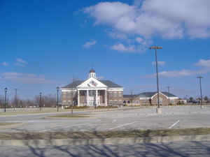
Nelson County is a county located in the state of Kentucky. Based on the 2010 census, the
population was 43,437. Nelson county was formed
from Jefferson County, Virginia in 1784 shortly after the Revolutionary
War. The county seat is Bardstown.
Nelson county is named for Thomas Nelson, Jr., a
Virginia Governor who signed the Declaration of Independence.
Nelson County comprises the Bardstown, KY Micropolitan Statistical Area, which is also included in the Louisville/Jefferson
County-Elizabethtown-Madison, KY-IN Combined Statistical Area.
Etymology - Origin of Nelson County Name
Thomas Nelson (1738-1789), Virginia governor and signer of the Declaration of Independence.
Demographics:
County QuickFacts: CensusBureau Quick Facts
Nelson County History
The fourth county created in what is now Kentucky was formed from Jefferson County, Virginia in 1784 shortly after the Revolutionary War. This county is located in the Western Knobs region of the state. The elevation in the county ranges from 390 to 1090 feet above sea level. In 2000 the county population was 37,477 in a land area of 422.63 square miles, an average of 88.7 people per square mile. The county seat is Bardstown.
Geography: Land and Water
As reported by the Census Bureau, the county has a total area of 424 square miles (1,100 km2), of which 418 square miles (1,080 km2) is land and 6.6 square miles (17 km2) (1.5%) is water.
Nelson county is located close to the center of Kentucky. The county’s mountainous land offers views of the Blue Ridge Mountains and the deep green magnificence of the George Washington National Forest, with the broad, winding James River establishing the southeast boundary.
Neighboring Counties
Bordering counties are as follows:
- Northeast: Spencer County; Anderson County
- East: Washington County
- Southeast: Marion County
- Southwest: Larue County; Hardin County
- Northwest: Bullitt County
Education
Two public school districts operate in the county:
The Nelson County School District
The Bardstown City Schools
Several private schools also operate in the county.


Click Image to Enlarge
