


Click Image to Enlarge
Kentucky Counties
Kentucky has one hundred and twenty counties, third in the US behind Texas's (254) and Georgia's (159.) Washington County was the first county formed in the Commonwealth of Kentucky when it reached statehood, and the sixteenth county formedOwsley County, Kentucky
Owsley County Education, Geography, and History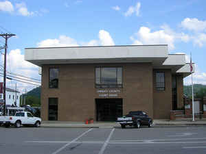
Owsley County is a county located in the Eastern Coalfield region of the state of Kentucky. Based on the 2010 census, the population was 4,755, making it the second-least populous county in Kentucky. The county was formed on January 23, 1843. The county seat is Booneville. Owsley county is named for William Owsley (1782-1862), the judge of the Kentucky Court of Appeals and Governor of Kentucky (1844-1848).
Etymology - Origin of Owsley County Name
William Owsley (1782-1862), judge in the Kentucky Court of Appeals, Kentucky governor.
Demographics:
County QuickFacts: CensusBureau Quick Facts
Owsley County History
Owsley County was formed in 1843 from portions of Clay, Breathitt, and Estill Counties and was named for Governor William Owsley.Owsley County was Kentucky's 96th county. Parts of Owsley County were used to form Jackson County in 1858 and Lee County in 1870.
This county is located in the Eastern Coal Field region of the state. In 2000 the county population was 4,858 in a land area of 198.09 square miles, an average of 24.5 people per square mile. The county seat is Booneville.
n January 1929, and again on January 5, 1967, there were courthouse fires. All records were lost in the 1929 fire.
Geography: Land and Water
As reported by the Census Bureau, the county has a total area of 198 square miles (510 km2), of which 197 square miles (510 km2) is land
and 0.9 square miles (2.3 km2) (0.4%) is water. The elevation
in the county ranges from 650 to 1720 feet above sea level.
Owsley county is located in east Kentucky.
The county is located in the Eastern Mountain Coal Fields which is a part the Cumberland Plateau
and is made up of slightly rolling farmland. The South Fork of the Kentucky River passes through the county.
Located on the northwest side of the county is in the Kentucky
River watershed. Flood plains along the banks of the South of the Kentucky River and several streams provide the level land necessary for farming.
A portion of the Daniel Boone National Forest is located in this county.
Neighboring Counties
Bordering counties are as follows:
- North: Lee County
- Northeast: Breathitt County
- Southeast: Perry County
- South: Clay County
- West: Jackson County
Education
Public schools are operated by the Owsley County School District. Owsley County has one Christian Private school currently operating. Sugar Camp Baptist Church maintains a primary educational facility off of Hwy. 30 East.


Click Image to Enlarge
