


Click Image to Enlarge
Kentucky Counties
Kentucky has one hundred and twenty counties, third in the US behind Texas's (254) and Georgia's (159.) Washington County was the first county formed in the Commonwealth of Kentucky when it reached statehood, and the sixteenth county formedWarren County, Kentucky
Warren County Education, Geography, and History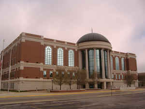
Warren County is a county located in the state of Kentucky. As of 2014, the
population was 120,460, making it the fifth-most populous
county in Kentucky. The county was formed in 1796. The
county seat is Bowling Green. Warren
county is named for General Joseph Warren of the
Revolutionary War.
Warren County is included in the Bowling Green, KY Metropolitan Statistical Area. It is located in the Pennyroyal Plateau and Western Coal
Fields regions.
Etymology - Origin of Warren County Name
General Joseph Warren of the Revolutionary War. He dispatched William Dawes and Paul Revere on their famous midnight ride to warn residents of the approaching British troops. He was also a hero of the Battle of Bunker Hill.
Demographics:
County QuickFacts: CensusBureau Quick Facts
Warren County History
Warren County was the location of several Native American villages and burial mounds. The first white men to enter
the area were the long hunters in the 1770s. General Elijah Covington was among the first landowners. McFadden's Station, one of the earliest
settlements, was established in 1785 by Andrew McFadden/McFadin on the northern bank of the Barren River at the Cumberland Trace.
Warren County became the 23rd county of Kentucky in 1796, from a section of Logan County.
The county is located in the Pennyrile and Western Coal Field regions of the state. In 2000 the county population was 92,522 in a land area of 545.21 square miles, an average of 169.7 people per square mile. The county seat is Bowling Green.
Generally the county is dry, prohibiting the sale of alcohol, but retail alcohol sales are allowed in the "wet city" of Bowling Green; Warren County is classified as a moist county.
Geography: Land and Water
As reported by the Census Bureau, the county has a total area of 548 square miles (1,420 km2), of which 542 square miles (1,400 km2) is land and 6.0 square miles (16 km2) (1.1%) is water. The elevation in the county ranges from 395 to 955 feet above sea level.
Warren county is located close to the center of Kentucky. This county is located in the Pennyroyal Plateau and Western Coal Fields regions.
Neighboring Counties
Bordering counties are as follows:
- Northeast: Edmonson County
- East: Barren County
- Southeast: Allen County
- Southwest: Simpson County; Logan County
- Northwest: Butler County
Education
Two public school districts operate in the county:
Warren County Public Schools, which serves most of the county.
Bowling Green Independent Schools, which serves most of the city of Bowling Green.
There are also private schools


Click Image to Enlarge
