


Click Image to Enlarge
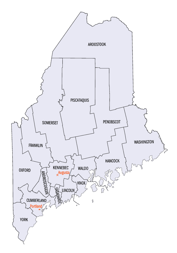
Maine Counties
There are sixteen Counties in Maine. Prior to statehood. The first county to be created was York County, created as York County, Massachusetts by the government of the Massachusetts Bay Colony in 1652. Maine was granted statehood on March 15, 1820 as part of the Missouri Compromise. Nine of the sixteen Counties had their borders defined while Maine was still part of Massachusetts, and hence are older than the state itself. Even after 1820, the exact location of the northern border of Maine was disputed with Britain, until the question was settled and the northern counties took their final, official form by treaty in 1845.York County, Maine
York County Education, Geography, and History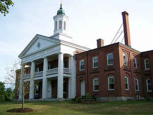
York County is a county located in the state of Maine. Based on the 2010 census, the population was 197,131,making it the second-most
populous county in Maine. Its county seat is Alfred. Founded in 1636, it is the oldest county in Maine and one of the oldest in the United
States.
York County is part of the Portland-South Portland, ME Metropolitan Statistical Area.
Etymology - Origin of York County Name
York was named for King James II of England, earlier Duke of York.
Demographics:
County QuickFacts: CensusBureau Quick Facts
York County History
History of York County, Maine
From: A Gazetteer of the State of Maine
By Geo. J. Varney
Published by B. B. Russell, 57 Cornhill,
Boston 1886
Transcribed by Betsey S. Webber
York County, forming the south-western portion of the
State, grew into its present name and form by degrees, and during a
long period. Its beginning may be considered to have been the estab-
lishment of the government of the Province of Maine in 1640, by the
proprietor, Sir Ferdinando Gorges. The limits of this province ex-
tended from the Piscataqua River to the Kennebec. The province
soon came to be considered as two districts, first spoken of as the East
and West districts, or counties, of which the Kennebunk River was re-
garded as the dividing line. The town of York being the shire town
of the western section, that portion gradually came to be called York
district, or county, the other being called Somerset, or New Somerset.
The Kennebunk River also proved to be the western boundary of the
temporary Province of Lygonia. In 1652, Maine came under the con-
trol of Massachusetts, and the Isles of Shoals and all the territory
northward of Piscataqua River to the White Mountains, and thence
eastward to Penobscot Bay, were included in the re-named and ex-
tended jurisdiction of Yorkshire. All this was overturned by the
King's commissioners in 1664, who revived the divisions as established
by Gorges, and formed the territory east of the Kennebec into the
county of Cornwall. In 1677, however, Massachusetts purchased the
Province of Maine of Gorges' heirs; and again Yorkshire was ex-
tended eastward as far as the Kennebec. In 1716, the General Court
ordered the extension of Yorkshire, so as to include all the settlements
eastward; and accordingly Penobscot Bay became again the eastern
boundary. In 1735, courts were ordered to be held at York and Fal-
mouth, and the county received its present name. The establishment
in 1760 of the new county of Cumberland, gave York County its pres-
ent boundary on that side. In 1805, Oxford County was formed, when
York County first assumed its present limits.
The Saco River passes through the eastern section, then forms its
boundary line for some fifteen miles on the north-east. The Ossipee
River continues this line ten miles or more further to the New Hamp-
shire line. The Salmon Falls River forms the western boundary line
for about thirty miles, and the Piscataqua continues it some ten miles
further to the sea. The other considerable rivers are the Little Ossipee,
Mousam, Kennebunk, Great Works, Little and York. In the northern
part there are numerous ponds; Little Ossipeee - somewhat north of
the center of the county - being the largest, except Great East Pond,
which is partly in New Hampshire. In the northern part the hills are
numerous, several of which are near 1,000 feet in height. Agamenticus
Mountain, 600 feet high, is the greatest elevation near the coast. The
rocks of the region are chiefly granitic; though at some points near the
coast they are argillaceous. The soil of the southern and eastern parts
of the county inclines to sandy loam, though clay, and clayey and
gravelly loam are frequent. The latter increases to the north, where
the soil becomes strong and productive, though often difficult to work
on account of the stones. The Portland and Rochester railroad crosses
the middle of the county from north-east to south-west, while the
Portland, Saco and Portsmouth, and the Boston and Maine railroads
follow a similar direction near the coast. The county contains twenty-
four towns and two cities; and three United States Customs districts,
Saco, Kennebunk and York, are within its limits. It has twenty-six
towns and two cities. The shire town is Alfred. The valuation in
1870 was $22,442,875. In 1880 it was $22,423,960. The population
in 1870 was 60,174; and in 1880, 62,299...York County
Geography: Land and Water
As reported by the Census Bureau, the county has a total area of 1,271 square miles (3,293 km2), of which, 991
square miles (2,566 km2) of it is land and 280 square miles (726 km2) of it (22.06%) is water.
Neighboring Counties
Bordering counties are as follows:
- Oxford County, Maine - north
- Cumberland County, Maine - northeast
- Rockingham County, New Hampshire - southwest
- Strafford County, New Hampshire - west
- Carroll County, New Hampshire - northwest
Education


Click Image to Enlarge
