

Click Image to Enlarge
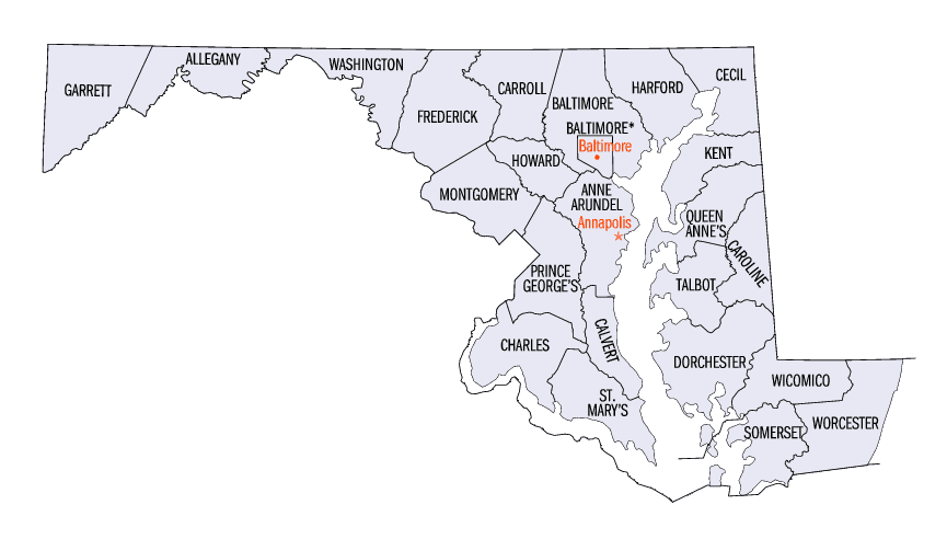
Maryland Counties
There are twenty-four counties and county-equivalents in Maryland. Though an independent city rather than a county, the City of Baltimore is considered the equal of a county. The last new county formation in Maryland occurred when Garrett County was formed in 1872 from portions of Allegany County.Caroline County, Maryland
Caroline County Education, Geography, and History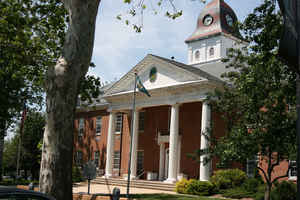
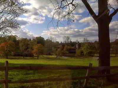
Caroline County is a rural county located in the state of Maryland on its Eastern Shore. Based on the 2010 census, the population was
33,066. Its county seat is Denton.
Caroline County is bordered by Queen Anne's County to the north, Talbot County to the west, Dorchester County to the south, Kent County,
Delaware, to the east, and Sussex County, Delaware, to the southeast
Etymology - Origin of Caroline County Name
Lady Caroline Eden, daughter of Charles Calvert, 5th Baron Baltimore
Demographics:
County QuickFacts: CensusBureau Quick Facts
Caroline County History
Caroline County was created in 1774 from parts of Dorchester and Queen Anne's counties. The county derives its name
from Lady Caroline Eden, wife of Maryland's last colonial governor, Robert Eden. At the time of its creation, seven commissioners were
appointed: Charles Dickinson, Benson Stainton, Thomas White, William Haskins, Richard Mason, Joshua Clark, and Nathaniel Potter. These men
bought 4 acres (1.6 ha) of land at Pig Point (now Denton) on which to build a courthouse and jail.
Until the completion of these buildings, court was held at Melvill's Warehouse, approximately 1.5 miles (2.4 km) above Pig Point. Elections
and other business transactions were completed there, and the town became the center of the county. The first court session was held on March
15, 1774, at Melvill's Warehouse. In 1777, court was moved to Bridgetown (now Greensboro), but in the interest of convenience, court was moved
back to Melvill's.
Disagreements arose concerning the permanent location of the county seat. The General Assembly reached a compromise in 1785 and ordered that 2
acres (0.81 ha) of land at Melvill's Landing should be purchased for a courthouse and jail. In 1790, the county court and its belongings moved
to Pig Point. The Caroline County Courthouse was completed in 1797
Geography: Land and Water
As reported by the Census Bureau, the county has a total area of 326 square miles (840 km2), of which 319 square miles (830 km2) is land
and 6.5 square miles (17 km2) (2.0%) is water. It is the second-smallest county by total area in Maryland. Notable waterways include the
Choptank River and Tuckahoe Creek, as well as the man-made Williston Lake in Caroline County.
Caroline County currently ranks seventh nationally in terms of land protected under the Ag Preservation Program.
Its eastern border is the Mason-Dixon line.
Caroline is the only Eastern Shore county not to touch either the Chesapeake Bay or Atlantic Ocean.
Tuckahoe State Park, Holiday Park Campgrounds and Martinak State Park are located in Caroline County.
Neighboring Counties
Bordering counties are as follows:
- Northeast: Kent County, Del.
- Southeast: Sussex County, Del.
- Southwest: Dorchester County; Talbot County
- Northwest: Queen Anne's County
Education


Click Image to Enlarge
