


Click Image to Enlarge
Maryland Counties
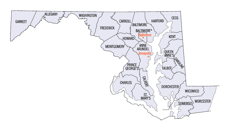
There are twenty-four counties and county-equivalents in Maryland. Though an independent city rather than a county, the City of Baltimore is considered the equal of a county. The last new county formation in Maryland occurred when Garrett County was formed in 1872 from portions of Allegany County.Garrett County, Maryland
Garrett County Education, Geography, and History
Garrett County is the westernmost county of the state of Maryland. Based on the 2010 census, the population was 30,097, making it the
third-least populous county in Maryland. Its county seat is Oakland. The county was named for John Work Garrett (1820-1884), president of the
Baltimore and Ohio Railroad. Created from Allegany County, Maryland in 1872, it was the last Maryland county to be formed.
Garrett County has long been part of the media market of Pittsburgh, Pennsylvania. It is considered to be a part of Western Maryland.
Etymology - Origin of Garrett County Name
John Work Garrett, president of the Baltimore and Ohio Railroad
Demographics:
County QuickFacts: CensusBureau Quick Facts
Garrett County History
The county was named for John Work Garrett (1820-1884), president of the Baltimore and Ohio Railroad. Created from Allegany County, Maryland in 1872, it was the last Maryland county to be formed.
In the early 20th century, the railroad and tourism started to decline. Coal mining and timber production continued at a much slower pace. Today, tourism has made a dramatic rebound in the county with logging and farming making up the greatest part of the economic base. Due to a cold climate and lack of any large city, Garrett County has remained a sparsely populated rural area.
Geography: Land and Water
As reported by the Census Bureau, the county has a total area of 656 square miles (1,700 km2), of which 647 square miles (1,680 km2) is
land and 8.6 square miles (22 km2) (1.3%) is water. It is the second-largest county in Maryland by land area.
Garrett County is Maryland's westernmost county, bordered to the north by the Mason-Dixon line with Pennsylvania, to the south by the Potomac
River and West Virginia, to the west by a land border with West Virginia, and to the east by a land border with Allegany County, Maryland. The
county's northwesternmost point is approximately 60 miles (97 km) southeast of Pittsburgh, Pennsylvania, and its southeasternmost point is
approximately 160 miles (260 km) northwest of Baltimore, Maryland.
Garrett County is located entirely within the highland zone of the Appalachian Mountains known variously as the Allegheny Mountains, the
Allegheny Plateau, and the Appalachian Plateau. The county's highest elevations are located along four flat-topped ridges and range to a
height of 3,360 feet (1,020 m) at Hoye-Crest along Backbone Mountain, the highest point in the state of Maryland. As is typical in the
Allegheny region, broad flats generally lie below the ridge crests at elevations of approximately 500 feet (150 m). River valleys are
generally narrow and deep, with ravines typically 1,000 to 1,800 feet (550 m) below surrounding peaks.
The county contains over 76,000 acres (310 km2) of parks, lakes, and publicly accessible forestland. It is drained by two river systems, the
Potomac and the Youghiogheny. The Savage River, a tributary of the Potomac, drains about a third of the county. The Casselman River, a
tributary of the Youghiogheny, flows north from the county' central section into Pennsylvania. The Youghiogheny itself drains the westernmost
area of the county and flows north into Pennsylvania, where it empties into the Monongahela River at McKeesport, just south of Pittsburgh.
Neighboring Counties
Bordering counties are as follows:
- Northeast: Somerset County, Pa.
- East: Allegany County
- Southeast: Mineral County, W.Va.
- South: Grant County, W.Va.
- West: Preston County, W.Va.
- Northwest: Fayette County, Pa.
Education


Click Image to Enlarge
