

Click Image to Enlarge
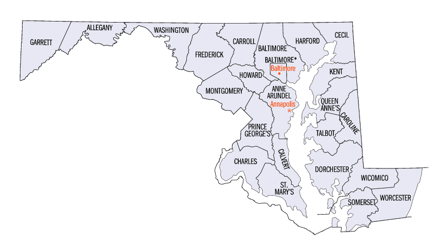
Maryland Counties
There are twenty-four counties and county-equivalents in Maryland. Though an independent city rather than a county, the City of Baltimore is considered the equal of a county. The last new county formation in Maryland occurred when Garrett County was formed in 1872 from portions of Allegany County.Kent County, Maryland
Kent County Education, Geography, and History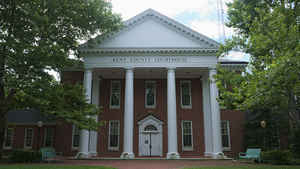
Kent County is a county located in the state of Maryland. Based on the 2010 census, its population was 20,197, making it the least populous county in Maryland. Its county seat is Chestertown. The county was named for the county of Kent in England. The county is located on Maryland's Eastern Shore.
Etymology - Origin of Kent County Name
The English county of Kent
Demographics:
County QuickFacts: CensusBureau Quick Facts
Kent County History
In 1642, the governor and council appointed commissioners for the Isle and County of Kent. This act appears to have led
to the establishment of Kent County. In 1675, the first county seat was New Yarmouth. The seat was briefly moved upriver to Quaker Neck, and
then to the site of modern Chestertown. Before the American Revolution New Town on Chester, now Chestertown, was a port entry for the counties
of Cecil, Kent, and Queen Anne's.
The county has a number of properties which are listed on the National Register of Historic Places.
In 1793, the county had its first newspaper, called Apollo, or Chestertown Spy. It was succeeded by local papers such as the Chestertown
Gazette.
Geography: Land and Water
As reported by the Census Bureau, the county has a total area of 413 square miles (1,070 km2), of which 277 square miles (720 km2) is
land and 136 square miles (350 km2) (33%) is water.
According to the Maryland Geological Survey, the highest point in Kent County is 102 ft above sea level, approximately 2.25 mi west of
Coleman's Corner (shown on maps as "Coleman"), just northeast of the mouth of Still Pond Creek.
Kent County is the smallest county in Maryland. It has a 209-mile shoreline, including Eastern Neck Island. The Chesapeake Bay is on the west,
Sassafras River on the north, and the Chester River on the south. The eastern border with Delaware is part of the Mason-Dixon line.
Neighboring Counties
Bordering counties are as follows:
- North: Cecil County
- Northeast: New Castle County, Del.
- Southeast: Kent County, Del.
- South: Queen Anne's County
- West: Chesapeake Bay
Education
Washington College, the oldest college in Maryland, is located in Kent County.


Click Image to Enlarge
