


Click Image to Enlarge
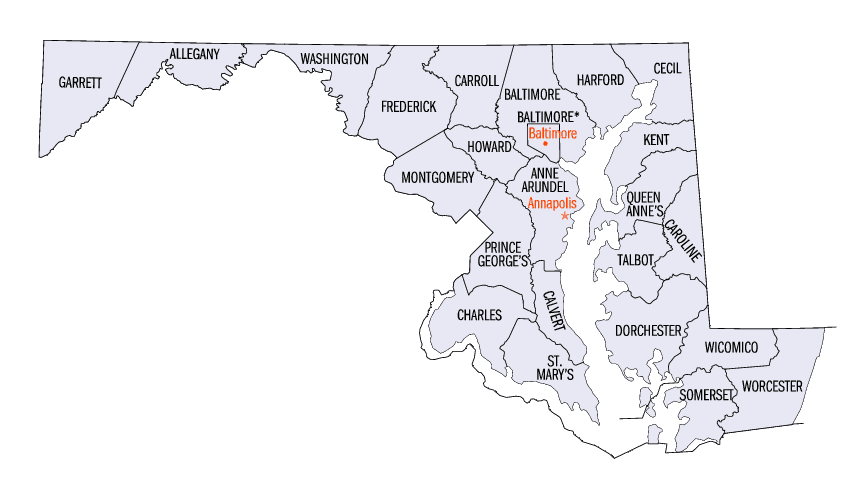
Maryland Counties
There are twenty-four counties and county-equivalents in Maryland. Though an independent city rather than a county, the City of Baltimore is considered the equal of a county. The last new county formation in Maryland occurred when Garrett County was formed in 1872 from portions of Allegany County.Queen Anne's County, Maryland
Queen Anne's County Education, Geography, and History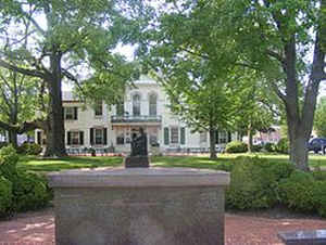
Queen Anne's County is a county located in the state of Maryland. Based on the 2010 census, the population was 47,798. Its county seat
and most populous municipality is Centreville. The census-designated place of Stevensville is the county's most populous place. The county is
named for Queen Anne of Great Britain who reigned when the county was established in 1706.
Queen Anne's County is included in the Baltimore-Columbia-Towson, MD Metropolitan Statistical Area, which is also included in the
Washington-Baltimore-Arlington, DC-MD-VA-WV-PA Combined Statistical Area.
Etymology - Origin of Queen Anne's County Name
Anne I, Queen of Great Britain
Demographics:
County QuickFacts: CensusBureau Quick Facts
Queen Anne's County History
Queen Anne's County has two hundred sixty-five miles of waterfront area, much of that being the shores of Kent
Island, which stands out from the eastern shore of the Chesapeake Bay. From the waters of this county, watermen have brought oysters, crabs,
and terrapin. Migrating waterfowl overwinter here, and hunting for geese and ducks has been an important part of the county's history. The
first settlement in Maryland was on Kent Island in August 21, 1631, and included twenty-five settlers in a manor house, a fort, and other
buildings. The settlement was referred to as Winston's Island. The first houses were built similar to log cabins. Although the county has a
number of properties on the National Register of Historic Places, the original settlement no longer exists. One of the oldest towns still
existing is Stevensville, earlier known as Broad Creek.
In 1650, Kent Island had the first recorded fox hunt in America. Queen Anne's County was organized under a sheriff in 1706, bounded by Talbot,
Kent, and Dorchester Counties. In 1713, Queen Anne's County became an English postal district where the sheriff was the postmaster and would
travel to Annapolis by boat to obtain mail. In 1773 a part of Queen Anne's County, together with a portion of Dorchester County, was taken to
form Caroline County. The county now is enclosed by Talbot, Caroline, and Kent County as well as the Chesapeake Bay.
By the time of Independence, the county had several churches, a government, school, and a postal system.
In 1876, Queen Anne's County had the first printed independent paper called the Maryland Citizen, and a bank, located in Centreville; the
Centreville National Bank exists to this day. When the Railroad Company was finished in 1868 it operated from Baltimore around the top of the
Chesapeake Bay down to Queenstown, and connected with other railroads that continued east into Delaware as far as Rehoboth, and southward to
the Eastern Shore of Virginia.
Geography: Land and Water
As reported by the Census Bureau, the county has a total area of 511 square miles (1,320 km2), of which 372 square miles (960 km2) is land and 139 square miles (360 km2) (27%) is water.
Neighboring Counties
Bordering counties are as follows:
- North: Kent County
- East: Kent County, Del.
- Southeast: Caroline County
- Southwest: Talbot County
- West: Anne Arundel County; Chesapeake Bay
Education
Chesapeake College


Click Image to Enlarge
