


Click Image to Enlarge
Michigan Counties
The boundaries of the eighty-three counties in Michigan have not changed substantially since 1897. Wayne County was the sixth county in the Northwest Territory, formed 15 August 1796 and organized in 1815. Wayne County was created 21 November 1815 as an original county of Michigan.Alger County, Michigan
Alger County Education, Geography, and History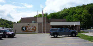
Alger County is a county in the Upper Peninsula of the state of Michigan. Alger County was detached from Schoolcraft County, set off and organized in 1885. Based on the 2010 census, the population was 9,601. Its county seat is Munising.
Etymology - Origin of Alger County Name
Alger County is named for Russell A. Alger, a Michigan Governor and US Senator.
Demographics:
County QuickFacts: CensusBureau Quick Facts
Alger County History
Alger County is named for Russell A. Alger, a Michigan Governor and US Senator. Detached from Schoolcraft County in 1885
Geography: Land and Water
As reported by the Census Bureau, the county has a total area of 5,048 square miles (13,070 km2), of which 915 square miles (2,370 km2) is land and 4,133 square miles (10,700 km2) (82%) is water. It is the second-largest county in Michigan by total area, mainly because of Lake Superior on the north side of the county.
Neighboring Counties
Bordering counties are as follows:
- Luce County (east)
- Schoolcraft County (southeast)
- Delta County (south)
- Marquette County (west)
Education


Click Image to Enlarge
