


Click Image to Enlarge
Michigan Counties
The boundaries of the eighty-three counties in Michigan have not changed substantially since 1897. Wayne County was the sixth county in the Northwest Territory, formed 15 August 1796 and organized in 1815. Wayne County was created 21 November 1815 as an original county of Michigan.Clinton County, Michigan
Clinton County Education, Geography, and History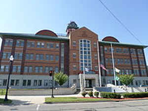
Clinton County is a county in the state of Michigan. Based on the 2010 census, the population was 75,382. The county seat is St. Johns.
The county was created in 1831 and organized in 1839. It is named after early American politician DeWitt Clinton.
Clinton County is included in the Lansing-East Lansing, MI Metropolitan Statistical Area.
Etymology - Origin of Clinton County Name
Clinton County is named for DeWitt Clinton, the Governor of New York under whom the Erie Canal was constructed.
Demographics:
County QuickFacts: CensusBureau Quick Facts
Clinton County History
Clinton County is named for DeWitt Clinton, the Governor of New York under whom the Erie Canal was constructed.
Set Off: 1831
Organized: 1839
Geography: Land and Water
As reported by the Census Bureau, the county has a total area of 575 square miles (1,490 km2), of which 566 square miles (1,470 km2) is land and 8.1 square miles (21 km2) (1.4%) is water.
Neighboring Counties
Bordering counties are as follows:
- Saginaw County (northeast)
- Gratiot County (north)
- Montcalm County (northwest)
- Shiawassee County (east)
- Ionia County (west)
- Ingham County (southeast)
- Eaton County (southwest)
Education


Click Image to Enlarge
