Michigan Counties
The boundaries of the eighty-three counties in Michigan have not changed substantially since 1897. Wayne County was the sixth county in the Northwest Territory, formed 15 August 1796 and organized in 1815. Wayne County was created 21 November 1815 as an original county of Michigan.Macomb County, Michigan
Macomb County Education, Geography, and History
Macomb County is a county located in the eastern portion of the state of Michigan. Based on the 2010 census, the population was 840,978,
making it the third-most populous county in the state. Of Michigan's five largest counties, Macomb experienced the most population growth
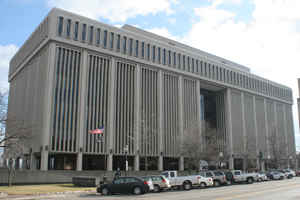
(6.7%) between 2000 and 2010. The county seat is Mt. Clemens.
Macomb County is part of the Detroit-Warren-Dearborn, MI Metropolitan Statistical Area. The city of Detroit is located south of 8 Mile Road,
the county's southern border.
Etymology - Origin of Macomb County Name
Macomb County is named for US General Alexander Macomb, a notable officer of the War of 1812.
Demographics:
County QuickFacts: CensusBureau Quick Facts
Macomb County History
Macomb County is named for US General Alexander Macomb, a notable officer of the War of 1812.
Set Off: 1818
Organized: 1818
The Ojibwa were the first settlers in the area. The first Europeans arrived in the area during the 17th century. A Moravian colony was established in the county in the late 18th Century. They included French fur trappers and missionaries. In addition to the original French and English, later
settlers included Germans, Belgians and others who came directly from Europe.
Macomb County was formally organized on January 15, 1818 as the third county in the Michigan territory. At that time, it covered a much larger area than it does today. In 1819 and 1820, large portions of the county were removed to form the counties of Oakland, Lapeer, Genesee and St. Clair. The
county was named in honor of General Alexander Macomb, Jr. a highly decorated veteran of the War of 1812.
The county gained fame in the 1980s and '90s as a bellwether of state and national politics. Macomb's large cohort of working-class, socially conservative whites gave it one of the nation's most prominent concentrations of "Reagan Democrats", and outsider candidates with a conservative-populist bent
have done well there in the past (e.g. George Wallace in 1968 and Pat Buchanan in 1992).
Geography: Land and Water
As reported by the Census Bureau, the county has a total area of 571 square miles (1,480 km2), of which 479 square miles (1,240 km2) is
land and 92 square miles (240 km2) (16%) is water. The county's southeastern border with Canada is located across Lake St. Clair.
Lake St. Clair borders the county on the east.
Far northern parts of the county, such as Richmond and Armada, are often considered to be part of Michigan's Thumb region.
Neighboring Counties
Bordering counties are as follows:
- Across Lake St. Clair lies Chatham-Kent (east) and Essex County (south), Ontario, Canada
- St. Clair County, Michigan - northeast
- Lapeer County, Michigan - northwest
- Oakland County, Michigan - west
- Wayne County, Michigan - south
Education


