


Click Image to Enlarge
Michigan Counties
The boundaries of the eighty-three counties in Michigan have not changed substantially since 1897. Wayne County was the sixth county in the Northwest Territory, formed 15 August 1796 and organized in 1815. Wayne County was created 21 November 1815 as an original county of Michigan.Monroe County, Michigan
Monroe County Education, Geography, and History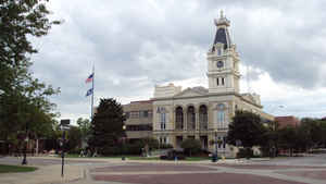
Monroe County is a county located in the state of Michigan. Based on the 2010 census, the population was 152,021. The largest city and
county seat is Monroe. The county was established as the second county (after Wayne County) in the Michigan Territory in 1817 and was named
for then-President James Monroe.
Monroe County comprises the Monroe, MI Metropolitan Statistical Area and is included in the Detroit-Warren-Ann Arbor, MI Combined Statistical
Area. It is unofficially considered a northerly extension of the Toledo Metropolitan Area.
Etymology - Origin of Monroe County Name
Monroe County is named for James Monroe, the fifth US President.
Demographics:
County QuickFacts: CensusBureau Quick Facts
Monroe County History
Monroe County is named for James Monroe, the fifth US President.
Set Off: 1817
Organized: 1817
Toledo was formerly part of Monroe County, but was ceded to Ohio as a consequences of the 1835 Toledo War. That was a dispute between Ohio and Michigan fought over a 500 square mile of land, which included the Maumee River's mouth. In exchange, Michigan got the Upper Peninsula, then considered a wilderness.
The Battle of Frenchtown, one of the bloodiest battles in War of 1812 was fought in Monroe County. It was the largest conflict ever fought on Michigan soil. The River Raisin Battlefield is being considered for inclusion in the National Parks System.
The City of Monroe is one of the most historic cities in Michigan, and has a well marked trail of the battlefield.
Geography: Land and Water
As reported by the Census Bureau, the county has a total area of 680 square miles (1,800 km2), of which 549 square miles (1,420 km2) is land and 131 square miles (340 km2) (19%) is water. Monroe is Michigan' only county on Lake Erie. The River Raisin and Sandy Creek flow through the county. Sterling State Park is the county' only state park and the only of Michigan' 98 state parks located on Lake Erie. The Detroit River International Wildlife Refuge extends south into Monroe County and includes part of the North Maumee Bay Archeological District. Monroe County sits at the lowest elevation in state of Michigan, which is the shores of Lake Erie at 571 feet (174 meters).
Neighboring Counties
Bordering counties are as follows:
- Wayne County (northeast)
- Washtenaw County (northwest)
- Essex County, Ontario, Canada (east)
- Lenawee County (west)
- Lucas County, Ohio (south)
Education
Monroe County contains nine public school districts. There are approximately 23,000 students in public schools in Monroe County. Public
school district boundaries are not conterminous with the county boundary or any municipality boundaries within the county. Monroe County is a
"district of choice" county, and students have the option to attend any district in the county, even if they do not live within a particular
district. Students near the county line, especially those in northern locations such as Milan, Flat Rock, Milan Township, and London Township,
are assigned to districts in the neighboring counties of Wayne and Washtenaw. Located primarily in Monroe County, Airport Community Schools
and Whiteford Agricultural Schools have boundaries that extend into neighboring counties, so a small number of out-of-county students attend
schools in Monroe County.
There are two charter schools in the county with a total of 750 students. There are also 15 parochial schools with approximately 2,200
students enrolled in the private sector. The county is also served by one independent school district, the Monroe County Intermediate School
District, which provides education services and staff support at all of the county's schools. Established in 1964 and first opened to students
in 1967, Monroe County Community College is the only higher education institution in the county. Marygrove College, sponsored by the local
Sisters, Servants of the Immaculate Heart of Mary (IHM), was founded in Monroe in 1905 as a Catholic, liberal arts college. The college then
moved to its current location in Detroit in 1927. The IHM also operated a boarding school, the Hall of the Divine Child, in Monroe from
1918-1980. Students in the county may also be homeschooled.


Click Image to Enlarge
