


Click Image to Enlarge
Minnesota Counties
There are eighty-seven Counties in Minnesota. On October 27, 1849 nine large Minnesota Counties were created. Among them were Benton, Dahkotah, Itasca, Ramsey, Mahkahta, Pembina, Wabashaw, Washington, and Wahnata. Of those Benton, Dakota, Itasca, Ramsey, Wabasha, and Washington still exist as their original name. With the creation of Kittson County on March 9, 1878, Pembina County no longer existed. When Minnesota was organized as a state, 57 of the present 87 Counties were established. The last county to be created was Lake of the Woods County in 1923Anoka County, Minnesota
Anoka County Education, Geography, and History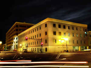
Anoka County is the fourth-most populous county in the state of Minnesota. Based on the 2010 census, the population was 330,844. The
county seat and namesake of the county is the City of Anoka,] which is derived from the Dakota word anokatanhan meaning "on (or from) both
sides," referring to its location on the banks of the Rum River. The largest city in the county is City of Coon Rapids, the twelfth largest
city in Minnesota and the seventh largest Twin Cities suburb.
Anoka County comprises the north portion of the Minneapolis-St. Paul-Bloomington, MN-WI Metropolitan Statistical Area, the largest
metropolitan area in the state and the sixteenth largest in the United States with about 3.3 million residents.
Etymology - Origin of Anoka County Name
From the Dakota word meaning "on both sides". County was named after the City of Anoka, which was laid out on both sides of the Rum River.
Demographics:
County QuickFacts: CensusBureau Quick Facts
Anoka County History
Anoka County was organized by an act of the territorial Legislature on May 23, 1857, the year prior to Minnesota's admission to the Union.
It was formed from parts of Ramsey County and Benton County; the Rum River previously divided the line between the two counties. The
boundaries were mainly the same as they are now, except for a small part of the southeastern tip along the Mississippi River and at the south,
formerly known as Manomin County. It was a small portion that connected to Ramsey and occupied one-third of the congressional township. It was
then attached to Anoka County by constitutional amendment November 2, 1869. It later became known as Fridley in 1879.
The first white men to explore what is now Anoka County were the Franciscan friar Louis Hennepin and two others in his party. Not soon after,
fur traders began to settle in the area which is now Ramsey County. They settled on the Rum River and more people were attracted to the area.
A community was created which is now called Anoka.
Geography: Land and Water
As reported by the Census Bureau, the county has a total area of 446 square miles (1,160 km2), of which 423 square miles (1,100 km2) is land and 23 square miles (60 km2) (5.2%) is water.
Neighboring Counties
Bordering counties are as follows:
- Isanti County (north)
- Chisago County (northeast)
- Washington County (southeast)
- Ramsey County (southeast)
- Hennepin County (southwest)
- Sherburne County (northwest)
Education


Click Image to Enlarge
