


Click Image to Enlarge
Minnesota Counties
There are eighty-seven Counties in Minnesota. On October 27, 1849 nine large Minnesota Counties were created. Among them were Benton, Dahkotah, Itasca, Ramsey, Mahkahta, Pembina, Wabashaw, Washington, and Wahnata. Of those Benton, Dakota, Itasca, Ramsey, Wabasha, and Washington still exist as their original name. With the creation of Kittson County on March 9, 1878, Pembina County no longer existed. When Minnesota was organized as a state, 57 of the present 87 Counties were established. The last county to be created was Lake of the Woods County in 1923Beltrami County, Minnesota
Beltrami County Education, Geography, and History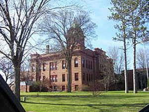
Beltrami County is a county located in the northern part of the state of Minnesota. Based on the 2010 census, the population was 44,442.
Its county seat is Bemidji. The county's name comes from the Italian count Giacomo Beltrami, who supposedly explored the area in 1825. The
county was created in 1866 and organized in 1896.
Beltrami County comprises the Bemidji, MN Micropolitan Statistical Area.
Etymology - Origin of Beltrami County Name
Named for Giacomo Costantino Beltrami, Italian explorer. Explored northern reaches of Mississippi River, 1823
Demographics:
County QuickFacts: CensusBureau Quick Facts
Beltrami County History
The territory of Minnesota was organized by an Act of Congress passed on March 3, 1849. By this organic act the
inhabitants of the new territory were accorded the same rights and privileges as had been previously given to the residents of the Territory
of Wisconsin. The State Constitution was adopted on October 13, 1857. Minnesota was admitted to the Union as a State on May 11, 1858.
Beltrami County was named after the Italian count Beltrami, an early explorer of the area. Beltrami County was created by an act of
Legislation on February 28, 1866 and was fully organized with Bemidji as the county seat on May 17, 1897.
Geography: Land and Water
As reported by the Census Bureau, the county has a total area of 3,056 square miles (7,920 km2), of which 2,505 square miles (6,490 km2) is land and 551 square miles (1,430 km2) (18%) is water. It is the fourth-largest county in Minnesota by area.
Neighboring Counties
Bordering counties are as follows:
- Lake of the Woods County (north)
- Koochiching County (northeast)
Itasca County (east) - Cass County (southeast)
- Hubbard County (south)
- Clearwater County (southwest)
- Pennington County (west)
- Marshall County (west)
- Roseau County (northwest)
Education


Click Image to Enlarge
