Minnesota Counties
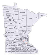
There are eighty-seven Counties in Minnesota. On October 27, 1849 nine large Minnesota Counties were created. Among them were Benton, Dahkotah, Itasca, Ramsey, Mahkahta, Pembina, Wabashaw, Washington, and Wahnata. Of those Benton, Dakota, Itasca, Ramsey, Wabasha, and Washington still exist as their original name. With the creation of Kittson County on March 9, 1878, Pembina County no longer existed. When Minnesota was organized as a state, 57 of the present 87 Counties were established. The last county to be created was Lake of the Woods County in 1923Blue Earth County, Minnesota
Blue Earth County Education, Geography, and History
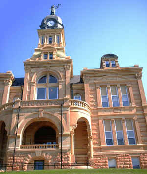
Blue Earth County is a county located in the State of Minnesota. Based on the 2010 census, the population was 64,013. Its county seat is
Mankato. The county is named for the Blue Earth River and for the deposits of blue-green clay once evident along the banks of the Blue Earth
River.
Blue Earth County is part of the Mankato-North Mankato, MN Metropolitan Statistical Area.
Etymology - Origin of Blue Earth County Name
From the Blue Earth River, named for blue-green earth found near its mouth and used by the Dakotas as pigment
Demographics:
County QuickFacts: CensusBureau Quick Facts
Blue Earth County History
The area of Blue Earth County was once known as the "Big Woods" and was occupied by the Dakota Indians. It was
started by a French explorer, Pierre-Charles Le Sueur. He was one of the first White people in this area, arriving at the point where the
Minnesota and Blue Earth rivers meet. There, he made an unsuccessful attempt to mine copper from the blue earth found in the area. The area
remained under French control until 1803, but soon after was passed to the United States by the Louisiana Purchase. When Minnesota became a
territory in 1849, the territorial government became interested in having the river valley for settlement. In 1850 the first steamboat trip,
starting in St. Paul, traveled on the Minnesota River and came to the Blue Earth River. The first White settlers, P.K. Johnson and Henry
Jackson came off the boat and settled in present day Mankato. The ratification of the Mendota and Traverse des Sioux Treaties in 1851
effectively forced the Dakota to leave the area for nearby reservations.
The county of Blue Earth was finally created after a division of the Minnesota Territory on March 5, 1853 from portions of Dakota County and
free territory. It was named after the Blue Earth River. The first government officials were appointed by Alexander Ramsey, who was the
territorial governor at that time. That October the first election was held for government officials with a total of 22 ballots being taken.
Geography: Land and Water
As reported by the Census Bureau, the county has a total area of 766 square miles (1,980 km2), of which 748 square miles (1,940 km2) is
land and 18 square miles (47 km2) (2.3%) is water. The Blue Earth River and Le Sueur River flow through a part of the county. The land surface
is relatively flat with over 30 lakes in the county.
There are many "closed forest savannas" that some call the big woods in the northeastern part of the county. The rivers that flow out of the
northeastern part are surrounded by these big woods. Most of the county is grassland prairie but scattered parts of it are wet prairie. Some
spots that surround the rivers are oak openings and barren brushland.
Neighboring Counties
Bordering counties are as follows:
- Nicollet County (north)
- Le Sueur County (northeast)
- Waseca County (east)
- Faribault County (south)
- Martin County (southwest)
- Watonwan County (west)
- Brown County (northwest)
Education


