


Click Image to Enlarge
Minnesota Counties
There are eighty-seven Counties in Minnesota. On October 27, 1849 nine large Minnesota Counties were created. Among them were Benton, Dahkotah, Itasca, Ramsey, Mahkahta, Pembina, Wabashaw, Washington, and Wahnata. Of those Benton, Dakota, Itasca, Ramsey, Wabasha, and Washington still exist as their original name. With the creation of Kittson County on March 9, 1878, Pembina County no longer existed. When Minnesota was organized as a state, 57 of the present 87 Counties were established. The last county to be created was Lake of the Woods County in 1923Brown County, Minnesota
Brown County Education, Geography, and History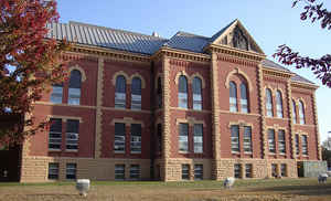
Brown County is a county located in the state of Minnesota. Based on the 2010 census, the population was 25,893. Its county seat is New
Ulm. The county was formed in 1855 and organized in 1856.
Brown County comprises the New Ulm, MN Metropolitan Statistical Area and is included in the Mankato-New Ulm-North Mankato, MN Combined
Statistical Area.
Etymology - Origin of Brown County Name
Named for Joseph Renshaw Brown, prominent pioneer, publisher of the Minnesota Pioneer, member of the territorial legislature, 1854-55, 1857
Demographics:
County QuickFacts: CensusBureau Quick Facts
Brown County History
Brown County was founded in 1855. It was named for Joseph Renshaw Brown, a member of the Governor's Council of Minnesota in 1855
The History of Brown County
In October, 1854, four men came to the home of Joseph La Framboise on the Minnesota River four miles below Fort Ridgely. The men were part
of a group seeking a place for settlement by the Chicago Land Verein. Friendly La Framboise suggested a site for their settlement at the
present location of New Ulm, but the first winter was spent at an abandoned Indian village in present Milford Township. This was near La
Framboise, and close to Fort Ridgely for supplies and protection.
In the Spring of 1855, the Chicago colonists moved to the present location of New Ulm. The name "New Ulm" was chosen because many of the
colonists came from the City of Ulm in Wurtemberg Province, Germany.
In February, 1855, the Territorial Legislature established Brown County, an area formerly in Blue Earth County. The size of territorial Brown
County was enormous, covering forty-two thousand square miles, west to Missouri River, and south to Iowa. Northward it included the Sioux
reservation lands south of the Minnesota River as far as Big Stone Lake to the northwest. After Minnesota became a state in 1858, Brown County
was frequently reduced in size as new counties were created. It has remained at its present size since 1865.
The county was named for Joseph Renshaw Brown, who came to Minnesota in 1819, and became well known as a trader, businessman, politician,
speculator, and inventor. In 1855 he was a member of the Territorial Council when the county was created.
On February 18, 1856, the Territorial Legislature declared Brown County an organized county and established New Ulm as the county seat.
In October, 1856, the first county election was held and the Board of County Commissioners had a meeting of three members. The commissioner
system was replaced for a short time from 1858 to 1860 by a Board of County Supervisors. In 1860 the commissioner system was restored and in
1869 the membership increased to its present five members, a standard number in Minnesota with 85 of the 87 counties using this system.
The coming of the Civil War in 1861 saw many volunteers leaving the sparsely settled county. When the Sioux uprising occurred in August, 1862,
the settlers were ill-prepared for self-protection. Many who were able to seek safety in flight from lesser settled regions came to New Ulm,
for one week from August 18th to the 25th, with but few weapons for defense, they built barricades within the center of town and were engaged
in two battles. By August 25th, when New Ulm was temporarily evacuated, over one hundred and forty were dead in the county and the loss of
property was enormous.
Before 1864, the Sioux Reservation land, which came to a point on the Little Cottonwood River about four miles above Lake Hanska, cut a huge
wedge out of Brown County. This greatly impeded settlement to the west. This reservation land was opened to settlement after the uprising.
Earliest settlement, mostly by Germans, was made along the Minnesota and Cottonwood Rivers and the adjacent prairies. As early as 1856,
however, the Norwegians discovered the beautiful lake county in the southeastern Brown County. The largest of these lakes, Lake Hanska,
meaning "long", retains its Sioux Indian name today.
Other nationalities soon followed the Germans and the Norwegians to Brown County. In 1860 a considerable number of Yankees lived along the
Cottonwood in present Stark Township. Irish, Danish and English immigrants also came, settling mostly in western Brown County after 1866.
An impetus was given to expanded settlement by the coming of the railroad to the county in 1872. By 1877 it extended west from New Ulm to
Springfield. The next year a spur was extended northwest of Sleepy Eye to Evan in Prairieville Township. By 1899 railroad transportation
covered the south part of the county with stations in Comfrey in Bashaw Township and Hanska in Lake Hanska Township.
Cottonwood, Leavenworth and Milford Townships were organized in 1858, Linden in 1859. Sigel in 1862, Home In 1866, Eden in 1867, Stark in
1868, Prairieville, Lake Hanska and Albin in 1870, Burnstown and Mulligan in 1871, North Star in 1873, and Stately in 1879. New Ulm was
incorporated in 1857, Sleepy Eye in 1878, Springfield in 1881, Comfrey in 1900, Hanska in 1901 and Evan in Cobden in 1904.
The geography of Brown County varies from the lake country in the southeast to the bluffs and wooded ridges along the Minnesota and Cottonwood
Rivers to the gently rolling plains and fields of western Brown County
Brown County is agriculturally oriented.
For more information about Brown County History, Contact the Brown County Historical Society
Geography: Land and Water
As reported by the Census Bureau, the county has a total area of 618 square miles (1,600 km2), of which 611 square miles (1,580 km2) is
land and 7.4 square miles (19 km2) (1.2%) is water.
The Minnesota River flows along the county's northern boundary; two of its tributaries, the Cottonwood and Little Cottonwood Rivers, flow
eastwardly through the county
Neighboring Counties
Bordering counties are as follows:
- Nicollet County (northeast)
- Blue Earth County (southeast)
- Watonwan County (south)
- Cottonwood County (southwest)
- Redwood County (west)
- Renville County (northwest)
Education


Click Image to Enlarge
