


Click Image to Enlarge
Minnesota Counties
There are eighty-seven Counties in Minnesota. On October 27, 1849 nine large Minnesota Counties were created. Among them were Benton, Dahkotah, Itasca, Ramsey, Mahkahta, Pembina, Wabashaw, Washington, and Wahnata. Of those Benton, Dakota, Itasca, Ramsey, Wabasha, and Washington still exist as their original name. With the creation of Kittson County on March 9, 1878, Pembina County no longer existed. When Minnesota was organized as a state, 57 of the present 87 Counties were established. The last county to be created was Lake of the Woods County in 1923Crow Wing County, Minnesota
Crow Wing County Education, Geography, and History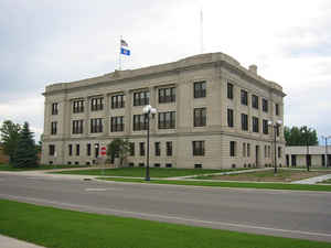
Crow Wing County is a county located in the state of Minnesota. Based on the 2010 census, the population was 62,500. Its county seat is
Brainerd. The county was formed in 1857 and organized in 1870.
Crow Wing County is included in the Brainerd, MN Micropolitan Statistical Area.
Etymology - Origin of Crow Wing County Name
Named after the Crow Wing River. Crow Wing is loose translation of Kagiwigwan, the Ojibway name for the river. A more accurate translation of this name may be "raven feather".
Demographics:
County QuickFacts: CensusBureau Quick Facts
Crow Wing County History
Crow Wing county was established on May 23, 1857 and organized March 3, 1870. It is named for the Crow Wing River,
which is itself named for an island in the river which is shaped like the wing of a crow.
Twenty years or more before the county was outlined and named, a trading post was established on the east side of the Mississippi River opposite the
mouth of the Crow Wing River. In 1837 there was again a station of the fur traders facing the northern mouth of the Crow Wing River. A few years
later it became the center of Indian trading and had the general supply store for the area. By 1866, the village contained about 600 whites and
Chippewas and was one of the major population centers in Minnesota. Although the county seat, Crow Wing was soon superseded by Brainerd and
eventually became a ghost town known as Old Crow Wing, its memory is preserved by Crow Wing State Park.
Brainerd township was founded in 1870 when the Northern Pacific survey determined that the crossing of the Mississippi should be there. It became a
city on November 19, 1881. The name was chosen in honor of the wife of J. Gregory Smith, the first president of the Northern Pacific Railroad
Company. Mrs. Brainerd Smith was the author of novels, books of travel and other works.
The part of Crow Wing County west of the Mississippi was annexed from Cass County by an act of the Legislature on February 18, 1887, doubling its
former area.
Geography: Land and Water
As reported by the Census Bureau, the county has a total area of 1,157 square miles (3,000 km2), of which 999 square miles (2,590 km2) is land and 157 square miles (410 km2) (14%) is water.
Neighboring Counties
Bordering counties are as follows:
- Aitkin County (northeast)
- Mille Lacs County (southeast)
- Morrison County (southwest)
- Cass County (northwest, north)
Education


Click Image to Enlarge
