


Click Image to Enlarge
Minnesota Counties
There are eighty-seven Counties in Minnesota. On October 27, 1849 nine large Minnesota Counties were created. Among them were Benton, Dahkotah, Itasca, Ramsey, Mahkahta, Pembina, Wabashaw, Washington, and Wahnata. Of those Benton, Dakota, Itasca, Ramsey, Wabasha, and Washington still exist as their original name. With the creation of Kittson County on March 9, 1878, Pembina County no longer existed. When Minnesota was organized as a state, 57 of the present 87 Counties were established. The last county to be created was Lake of the Woods County in 1923Dakota County, Minnesota
Dakota County Education, Geography, and History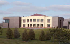
Dakota County is the third-most populous county in the state of Minnesota. Based on the 2010 census, the population was 398,552. The
county seat is Hastings. Dakota County is named after the Dakota Sioux tribal bands who settled in the area. The name is recorded as "Dahkotah"
in the United States Census records until 1851.
Dakota County is included in the Minneapolis-St. Paul-Bloomington, MN-WI Metropolitan Statistical Area, the sixteenth largest metropolitan
area in the United States with about 3.3 million residents. The county is bordered by the Minnesota and Mississippi Rivers on the north, and
the state of Wisconsin on the east.
Etymology - Origin of Dakota County Name
Named for the Dakota people, meaning an alliance or league
Demographics:
County QuickFacts: CensusBureau Quick Facts
Dakota County History
The county was the site of historical events at Mendota that defined the state's future, including providing materials for the construction of Fort Snelling across the river and the signing of the Treaty of Traverse des Sioux which ceded land from the native Dakota nation for the Minnesota Territory. The county's history was initially tied to the confluence of the Mississippi and Minnesota Rivers, both strategically important for United States expansion and as the convergence of the Dakota and Ojibwe nations who regarded the site as sacred.
After the establishment of the Minnesota Territory in 1849, Dakotah County (later Dakota County) spanned from the Mississippi River to the Missouri River. By the time Minnesota achieved statehood in 1858, power and influence had shifted from Mendota, across the rivers to Saint Paul and Minneapolis.
Founded in 1849, Dakota County was one of the original nine counties created by the Minnesota Territory Legislature. Thus, it was established before Minnesota was considered a state. The County seat moved to Hastings in 1857, where it has remained.
Geography: Land and Water
As reported by the Census Bureau, the county has a total area of 587 square miles (1,520 km2), of which 562 square miles (1,460 km2) is land and 25 square miles (65 km2) (4.2%) is water. The surface is nearly level.
Neighboring Counties
Bordering counties are as follows:
- Ramsey County (north)
- Washington County (northeast)
- Pierce County, Wisconsin (east)
- Goodhue County (southeast)
- Rice County (southwest)
- Scott County (west)
- Hennepin County (northwest)
Education
Dakota County is home to the state's largest school districts and some of the highest paid Superintendents. Nationally recognized
Independent School District 196 (Rosemount-Apple Valley-Eagan) houses 28,000 and is the fourth largest school district in the state.
Other districts include Independent School District 191 (Burnsville-Eagan-Savage School District), Independent School District 194
(Lakeville-Elko-New Market), Independent School District 197 (West St. Paul-Mendota Heights-Eagan) and Independent School District 200
(Hastings).
Colleges and universities
Dakota County Technical College
Inver Hills Community College


Click Image to Enlarge
