


Click Image to Enlarge
Minnesota Counties
There are eighty-seven Counties in Minnesota. On October 27, 1849 nine large Minnesota Counties were created. Among them were Benton, Dahkotah, Itasca, Ramsey, Mahkahta, Pembina, Wabashaw, Washington, and Wahnata. Of those Benton, Dakota, Itasca, Ramsey, Wabasha, and Washington still exist as their original name. With the creation of Kittson County on March 9, 1878, Pembina County no longer existed. When Minnesota was organized as a state, 57 of the present 87 Counties were established. The last county to be created was Lake of the Woods County in 1923Douglas County, Minnesota
Douglas County Education, Geography, and History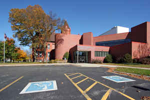
Douglas County is a county located in the state of Minnesota. Based on the 2010 census, the population was 36,009. Its county seat is
Alexandria. Douglas County was established in 1858. It is named for Stephen Douglas, of Illinois. The county was formed in 1858 and organized
in 1866.
Douglas County comprises the Alexandria, MN Micropolitan Statistical Area.
Etymology - Origin of Douglas County Name
Named for Stephen Arnold Douglas, member of Congress from Illinois 1843-47, US Senator from Illinois, 1847-61; candidate for president in 1860; advocated Minnesota statehood as chairman of Senate Committee on Territories.
Demographics:
County QuickFacts: CensusBureau Quick Facts
Douglas County History
The Douglas County area was first settled in 1858, the same year that Minnesota became a state. In 1862, the
settlements were all but abandoned due to Sioux Indian uprisings in the area and all records made were lost. It was many months later before
settlers began again moving back to the region. By 1866, treaties had been signed with the Sioux and it was in that year that Douglas County's
borders were officiallyset. Douglas County was named for Sen. Stephen A. Douglas who helped get the county established. The first board of
commissioners were appointed by the State Legislature in the spring of 1866 and the Commissioners soon appointed the first officers of Douglas
County. At the first meeting of the county board, two townships were established - Alexandria Township and Osakis Township.
The settlement of Alexandria began when Alexander and William Kinkead built a log cabin and hotel along the shore of Lake Agnes in 1858. It
was the Kinkead brothers who named the area "Alexandria". The land which became the official town site and the county seat was purchased in
1867 by William E. Hicks. The town itself soon expanded as Mr. Hicks built a general store, provided land for the Kinkead Cemetery and donated
land for three churches. Mr. Hicks also started the town's first newspaper, built a flour mill and joined forces with Thomas Cowing to erect a
saw mill near Lake Latoka. The signing of the Homestead Act in 1862 by President Abraham Lincoln gave people the ability to own property if
they lived and worked the land. Under those provisions, the area was quickly settled by European immigrants and Civil War veterans. By 1869,
almost all of the county's tillable land was claimed. With the increase of citizens in the region, additional towns were soon created to
provide goods and services to the settlers in the outlying areas of the county.
The official business of the county was held in officer's homes until 1867 when the county commissioners voted to rent a small frame building
on Main Street for the county offices. The first county jail was built in 1868. It was a 12 x 14 foot building of oak timbers with ceiling,
floors, and walls one half foot thick. In 1875, the widow of William Hicks donated Block 34 of the Original Town Site of Alexandria to the
county with the provision that it be used for building a courthouse. The second floor was used as a courtroom. This building was used for over
20 years until the first courthouse at the present location was built in 1880 with a brick jail on the same lot.
The county government went through a reorganization in 1888 and new commissioners were appointed by the State Legislature. This was the last
appointed county board as county commissioners have been chosen through the election process since.
Geography: Land and Water
As reported by the Census Bureau, the county has a total area of 720 square miles (1,900 km2), of which 637 square miles (1,650 km2) is
land and 83 square miles (210 km2) (11%) is water. It contains more than 250 lakes.
The county includes two of Minnesota's biomes: prairie grassland in the west and southeast, savannas (also prairie ecosystems) in the middle,
and temperate deciduous forest in the south-central, north, and east.
Douglas is one of 17 Minnesota counties where savanna soils dominate.
Neighboring Counties
Bordering counties are as follows:
- Otter Tail County (north)
- Todd County (east)
- Stearns County (southeast)
- Pope County (south)
- Stevens County (southwest)
- Grant County (west)
Education


Click Image to Enlarge
