


Click Image to Enlarge
Minnesota Counties
There are eighty-seven Counties in Minnesota. On October 27, 1849 nine large Minnesota Counties were created. Among them were Benton, Dahkotah, Itasca, Ramsey, Mahkahta, Pembina, Wabashaw, Washington, and Wahnata. Of those Benton, Dakota, Itasca, Ramsey, Wabasha, and Washington still exist as their original name. With the creation of Kittson County on March 9, 1878, Pembina County no longer existed. When Minnesota was organized as a state, 57 of the present 87 Counties were established. The last county to be created was Lake of the Woods County in 1923Faribault County, Minnesota
Faribault County Education, Geography, and History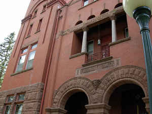
Faribault County is a county located in the state of Minnesota. Based on the 2010 census, the population was 14,553. Its county seat is Blue Earth. The county was founded in 1855. It is named for Jean-Baptiste Faribault, a settler and French fur trader among the Sioux Indians
Etymology - Origin of Faribault County Name
Named for Jean Baptiste Faribault, first white settler to farm in Minnesota. Major figure in trade with the Dakotas, 1803-60.
Demographics:
County QuickFacts: CensusBureau Quick Facts
Faribault County History
On the twentieth day of February, an act was passed entitled "An Act to Define the Boundaries of Certain
Counties." By section six of said act, it is enacted, "That so much territory as is embraced in the following boundaries, be and the same is
hereby established as the county of Faribault: beginning at the southwest corner of township one hundred and one (101) north, range
twenty-three (23) west, running thence west on the boundary line between the territory of Minnesota and the state of Iowa, thirty-six miles to
the township line, between ranges twenty-nine (29) and thirty (30) west; thence north on said township line twenty-four miles to the township
line, between one hundred and four (104) and one hundred and five (105) north; thence east on said line thirty-six (36) miles to the township
line between range twenty-three and twenty-four west; thence south on said township line twenty-four (24) miles to the place of be-ginning."
An apportionment of the territory was made at the same session of the legislature, for legislative purposes. District number ten (10), was
composed of the counties of Le Sueur, Steele, Faribault, Blue Earth, Brown, Nicollet, Sibley, Pierce and Renville, and was entitled to one
councilman and three representatives.
The county of Faribault was so named in honor of Jean Baptiste Faribault. Gen. Henry H. Sibley, a gentleman of distinguished character and abilities, and as well acquainted with the early history of the State, its prominent men and public affairs, as any other person in the State
ORGANIZATION OF THE COUNTY.
AN ACT TO ORGANIZE THE COUNTY OF FARIBAULT AND TO ESTABLISH THE COUNTY SEAT OF SAID COUNTY.
(Passed February 23, 1856.)
Section 1. - Be It enacted by the legislative assembly of the territory of Minnesota: That the county of Faribault be, and the same Is hereby
declared to be, an organized county, and invested with all the rights, privileges and immunities to which all organized counties In this
territory are entitled by law.
Sec 2 - That "Blue Earth City," situated between the fork of the Blue Earth river, as laid out and named by James B. Wakefield and others, he
and the same Is hereby declared to be the temporary county seat of said county and the county commissioners to be appointed, as hereafter
provided, shall have full power to locate the county building thereon.
Sec. 3. - That the Governor shall appoint and commission three suitable persons, the same being qualified voters of said county, to be a board
of county commissioners for said county, with full power and authority to perform all acts and discharge all duties devolving upon the board
of county commissioners of any organized county in this territory. And that he shall also appoint and commission one sheriff, a register of
deeds, and two justices of the peace for said county, who shall hold their offices respectively until their successors shall have been duly
elected and qualified.
Sec 4. - The said county of Faribault shall be attached to the county of Blue Earth for judicial purposes.
Sec 5. - That at the next general election, the inhabitants of said county shall determine by vote, where the county seat of said county shall
be located and all male inhabitants of said county, over the age of twenty-one years, who have acquired an actual residence in said county,
shall have the right to vote on the location of said county seat.
Sec 6 - This act shall take effect from and after Its passage.
Geography: Land and Water
As reported by the Census Bureau, the county has a total area of 722 square miles (1,870 km2), of which 712 square miles (1,840 km2) is land and 9.4 square miles (24 km2) (1.3%) is water.
Neighboring Counties
Bordering counties are as follows:
- Blue Earth County (north)
- Waseca County (northeast)
- Freeborn County (east)
- Winnebago County, Iowa (southeast)
- Kossuth County, Iowa (southwest)
- Martin County (west)
Education


Click Image to Enlarge
