


Click Image to Enlarge
Minnesota Counties
There are eighty-seven Counties in Minnesota. On October 27, 1849 nine large Minnesota Counties were created. Among them were Benton, Dahkotah, Itasca, Ramsey, Mahkahta, Pembina, Wabashaw, Washington, and Wahnata. Of those Benton, Dakota, Itasca, Ramsey, Wabasha, and Washington still exist as their original name. With the creation of Kittson County on March 9, 1878, Pembina County no longer existed. When Minnesota was organized as a state, 57 of the present 87 Counties were established. The last county to be created was Lake of the Woods County in 1923Lake County, Minnesota
Lake County Education, Geography, and History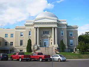
Lake County is a county located in the state of Minnesota. Based on the 2010 census, the population was 10,866. Its county seat is Two Harbors.
Etymology - Origin of Lake County Name
Named for the Lake Superior, which forms the southeastern boundary of the county.
Demographics:
County QuickFacts: CensusBureau Quick Facts
Lake County History
Lake County was founded on February 20, 1855, as Superior County, though its name was changed on March 3, of that year
to Saint Louis County. On March 1, 1856, Saint Louis County became Lake County, while Newton County to the west was renamed Saint Louis
County.
Prior to the arrival of Europeans, the area had long been inhabited by Native American groups. At the time of European contact, the principal
Native American groups in the region were the Dakota (Sioux) and Ojibwe (also called Anishinabe or Chippewa). The economy of these groups was
based on hunting, fishing and gathering, with wild rice being of particular importance. The first Europeans to explore the area were the
French in the late 17th century who were followed by trappers, fur traders, missionaries, and explorers. Beaver Bay was the first city in Lake
County in 1855.
Geography: Land and Water
As reported by the Census Bureau, the county has a total area of 2,991 square miles (7,750 km2), of which 2,109 square miles (5,460 km2)
is land and 881 square miles (2,280 km2) (29%) is water. It is the fifth-largest county in Minnesota by area.
Lake County is located in the Arrowhead Region of Northeastern Minnesota covering 2,062 miles. Lake County is known for its spectacular
natural beauty and within its boundaries are four state parks and a National Forest. Lake County offers superior hiking, camping, fishing and
winter recreational opportunities. Lake County has Lake Superior, the largest freshwater lake in the world right at its side. With its rugged
beauty and pristine shoreline, Lake County offers many recreational opportunities as well as historical shipwrecks, two operating lighthouses
and two public marinas. Lake County is home to mining, logging, wood products, lumbering, shipping and transportation, manufacturers, great
health care and tourism for all ages.
Neighboring Counties
Bordering counties are as follows:
- Rainy River District, Ontario (north)
- Cook County (east)
- Ashland County, Wisconsin (southeast)
- Bayfield County, Wisconsin (south)
- Douglas County, Wisconsin (south)
- Saint Louis County (west)
Education


Click Image to Enlarge
